|
search place name
|
||
Ấp Tân Ðinh (Vietnam)Ấp Tân Ðinh is a town in Vietnam. An overview map of the region around Ấp Tân Ðinh is displayed below.
regional and 3d topo map of Ấp Tân Ðinh, Vietnam ::

Ấp Tân Ðinh airports ::
The nearest airport is DAD - Danang Intl, located 216.7 km south east of Ấp Tân Ðinh.
Other airports nearby include ZVK - Savannakhet (227.6 km south west), Nearby towns ::
Ấp Diên Tang (2.6km south east) //
Tả Tháng (4.1km south west) //
Mỹ Trung (4.1km south west) //
Tráng Tiệp (4.0km south west) //
Cửa Thôn (5.1km south east) //
Thạch Xá Bắc (5.1km south west) //
Trung Quan (5.3km west) //
Hiển Vinh (5.6km west) //
Hiển Lộc (5.6km west) //
Hữu Hậu (5.6km west) //
Thạch Xá Xạ (5.8km south) //
Quang Xá (6.5km south west) //
Thế Lộc (6.6km south west) //
Thạch Xá Hạ (2) (7.6km south) //
Bối Sơn (7.6km south) //
Hữu Niên (7.3km west) //
Quảng Ninh (7.3km west) //
Hữu Tiệp (7.3km west) //
Thôn Hạ (7.3km west) //
Hữu Hưng (7.3km west) //
Trung Quán (8.0km south west) //
Vĩnh Lộc (9.1km south west) //
Hoành Phổ (9.1km south west) //
Ðồng Tư (9.0km south west) //
Cổ Hiền (9.0km south west) //
Lộc Long (10.2km south west) //
[all distances 'as the bird flies' and approximate] 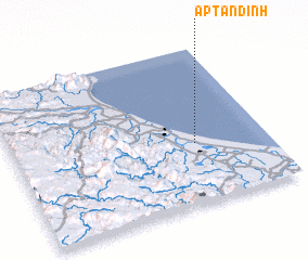 Places with similar names to Ấp Tân Ðinh, Vietnam ::
// Ấp Ðịnh Tan (VN)
// Ấp Tân Ðiền (VN)
// Ấp Tân Ðiền (VN)
// Ấp Tân Ðịnh (VN)
// Ấp Tân Ðinh (VN)
// Ấp Tan Tiên (VN)
Disclaimer :: Information on this page comes without warranty of any kind |
||
|
Where is Ấp Tân Ðinh? Elevation and coordinates ::
Latitude (lat): 17°23'0"N Longitude (lon): 106°43'0"E
Elevation (approx.): 3m (map arrows pan, magnifying glasses zoom) |
||
|
Visiting Ấp Tân Ðinh? Hotel/Accommodation ::
Book a hotel in Ấp Tân Ðinh Travel Guide ::
Buy a travel guide for Vietnam rental cars ::
car rental offers GPS waypoint ::
download a GPX waypoint (PoI) of Ấp Tân Ðinh for your GPS receiver
|
||