|
search place name
|
||
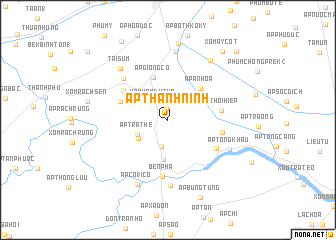
Ấp Thạnh Ninh (Sóc Trăng, Vietnam)Ấp Thạnh Ninh is a town in the Sóc Trăng region of Vietnam. An overview map of the region around Ấp Thạnh Ninh is displayed below.
regional and 3d topo map of Ấp Thạnh Ninh, Vietnam ::
Ấp Thạnh Ninh airports ::
The nearest airport is SGN - Ho Chi Minh City Tansonnhat Intl, located 165.2 km north east of Ấp Thạnh Ninh.
Nearby towns ::
Xóm Trây Mắm (1.3km north) //
Xóm Vàm Dù Tho (2.6km north west) //
Thạnh Thới An (3.1km south) //
Ấp Trà Thê (3.8km south west) //
Ấp Tầm Lôn (3.8km south west) //
Ấp Bà Trùm (4.4km south) //
Ấp Giồng Có (5.0km north) //
Ấp An Hòa (5.1km north east) //
Ấp Tắc Gòng (5.6km west) //
Xóm Bu Chum (5.9km north west) //
Ấp Thới Hiệp (6.0km east) //
Ấp Thới Thanh (6.1km east) //
Ấp Thanh An (6.2km south east) //
Bến Phà (6.4km south) //
Ấp Tà Bâm (6.7km north west) //
Xóm Rẫy (7.3km south) //
Ấp Tổng Khâu (7.5km south east) //
Mỹ Xuyên (7.7km north) //
Tài Sum (7.8km north west) //
Ấp Co18 Cò (8.0km south west) //
Xóm Ha Bo (8.1km north east) //
Bãi Xàu (8.6km north) //
Ấp Bưng Tung (9.4km south east) //
Xóm Ay Cốt (9.7km north east) //
Ðại Tâm (10.1km north west) //
Ấp Bùng Chông (10.7km north east) //
[all distances 'as the bird flies' and approximate] 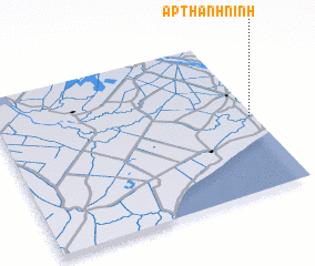 Places with similar names to Ấp Thạnh Ninh, Vietnam ::
// Ấp Thành Ninh (VN)
Disclaimer :: Information on this page comes without warranty of any kind |
||
|
Where is Ấp Thạnh Ninh? Elevation and coordinates ::
Latitude (lat): 9°28'54"N Longitude (lon): 105°58'51"E
Elevation (approx.): 1m (map arrows pan, magnifying glasses zoom) |
||
|
Visiting Ấp Thạnh Ninh? Hotel/Accommodation ::
Book a hotel in Ấp Thạnh Ninh Travel Guide ::
Buy a travel guide for Vietnam rental cars ::
car rental offers GPS waypoint ::
download a GPX waypoint (PoI) of Ấp Thạnh Ninh for your GPS receiver
|
||