|
search place name
|
||
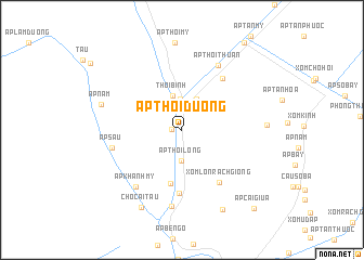
Ấp Thới Dương (Cà Ma, Vietnam)Ấp Thới Dương is a town in the Cà Ma region of Vietnam. An overview map of the region around Ấp Thới Dương is displayed below.
regional and 3d topo map of Ấp Thới Dương, Vietnam ::
Ấp Thới Dương airports ::
The nearest airport is SGN - Ho Chi Minh City Tansonnhat Intl, located 238.2 km north east of Ấp Thới Dương.
Nearby towns ::
Ấp Khánh Tường (1.1km west) //
Ấp Thới Phước (3.2km north) //
Ấp Thới Long (3.2km south) //
Ấp Thới Hậu (3.6km north east) //
Thới Bình (3.7km north) //
Ấp Khánh Thiện (5.6km south) //
Xóm Ông Nhơn (6.6km south) //
Xóm Lớn Rạch Giồng (6.6km south east) //
Ấp Thới Thiện (6.7km north east) //
Ấp Sáu (7.4km west) //
Ấp Khánh Mỹ (7.5km south west) //
Ấp Thới Thuận (7.6km north east) //
Xóm Sở (7.9km south) //
Ấp Năm (8.6km west) //
Xóm Cây Ðiều (8.7km east) //
Chợ Cái Tàu (9.0km south west) //
Ấp Bà Nhàn (9.2km south east) //
Ấp Cái Giữa (10.9km south east) //
[all distances 'as the bird flies' and approximate] 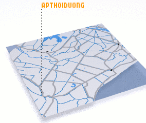 Places with similar names to Ấp Thới Dương, Vietnam ::
// Ấp Thi Tường (VN)
Disclaimer :: Information on this page comes without warranty of any kind |
||
|
Where is Ấp Thới Dương? Elevation and coordinates ::
Latitude (lat): 9°19'8"N Longitude (lon): 105°5'32"E
Elevation (approx.): 3m (map arrows pan, magnifying glasses zoom) |
||
|
Visiting Ấp Thới Dương? Hotel/Accommodation ::
Book a hotel in Ấp Thới Dương Travel Guide ::
Buy a travel guide for Vietnam rental cars ::
car rental offers GPS waypoint ::
download a GPX waypoint (PoI) of Ấp Thới Dương for your GPS receiver
|
||