|
search place name
|
||
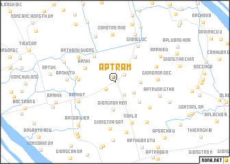
Ấp Trạm (Trà Vinh, Vietnam)Ấp Trạm is a town in the Trà Vinh region of Vietnam. An overview map of the region around Ấp Trạm is displayed below.
regional and 3d topo map of Ấp Trạm, Vietnam ::
Ấp Trạm airports ::
The nearest airport is SGN - Ho Chi Minh City Tansonnhat Intl, located 122.3 km north of Ấp Trạm.
Other airports nearby include PNH - Phnom-penh Phnom Penh Intl (255.0 km north west), Nearby towns ::
Ấp Dầu Giồng (1.9km north east) //
Ấp Chòm Chúi (1.9km south west) //
Sóc Ruộng (2.5km south east) //
Công Chậy (3.5km south east) //
Ấp Chông Giãng (4.2km east) //
Giồng Nom Men (4.5km south) //
Chong Bát (5.1km south east) //
Ấp Dầu Giồng (2) (5.2km north east) //
Ấp Ngãi Lộc (5.3km north west) //
Ấp Nhi (5.3km north west) //
Ấp Ba (2) (5.9km west) //
Ấp Ba (3) (6.2km west) //
Ấp Nhứt (6.7km south west) //
Giồng Lức (6.9km north east) //
Giồng Nô Ngéc (6.9km east) //
Ấp Long Trường (6.9km south east) //
Xóm Lo (7.1km south) //
Ấp Cang Nom (7.1km east) //
Ấp Thanh Ðường (7.2km north west) //
Giồng Trà Sầt (7.6km south) //
Ấp Trường Thọ (7.6km east) //
Xóm Ô Tre Nhỏ (7.8km north) //
Ấp Nhứt (3) (7.7km west) //
Xóm Ô Lon (1) (8.1km north west) //
Ấp Ðàng Lâm (8.3km south east) //
Giồng Ba Cam (8.4km south) //
Thạnh Mỹ (8.5km north) //
Ấp Phiếu (8.5km north east) //
Ấp Ngãi Thuận (8.8km west) //
[all distances 'as the bird flies' and approximate] 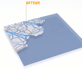 Places with similar names to Ấp Trạm, Vietnam :: Disclaimer :: Information on this page comes without warranty of any kind |
||
|
Where is Ấp Trạm? Elevation and coordinates ::
Latitude (lat): 9°45'47"N Longitude (lon): 106°19'14"E
Elevation (approx.): 2m (map arrows pan, magnifying glasses zoom) |
||
|
Visiting Ấp Trạm? Hotel/Accommodation ::
Book a hotel in Ấp Trạm Travel Guide ::
Buy a travel guide for Vietnam rental cars ::
car rental offers GPS waypoint ::
download a GPX waypoint (PoI) of Ấp Trạm for your GPS receiver
|
||