|
search place name
|
||
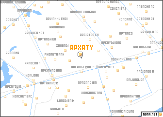
Ấp Xã Tỷ (Bạc Liêu, Vietnam)Ấp Xã Tỷ is a town in the Bạc Liêu region of Vietnam. An overview map of the region around Ấp Xã Tỷ is displayed below.
regional and 3d topo map of Ấp Xã Tỷ, Vietnam ::
Ấp Xã Tỷ airports ::
The nearest airport is SGN - Ho Chi Minh City Tansonnhat Intl, located 211.1 km north east of Ấp Xã Tỷ.
Nearby towns ::
Ấp Ut Thượng (2.7km west) //
Ấp Láng Tròn (3.1km south) //
Xóm Ba Ðình (4.1km north west) //
Ấp Ðồng Lớn (4.2km north east) //
Ấp Gia Tuốch (4.7km north east) //
Phong Thạnh (6.0km west) //
Xóm Cây Mét (6.4km south east) //
Ấp Ngân Ðiền (6.8km south) //
Ấp Kim Xĩa (2) (6.9km north west) //
Ấp Láng Nẩy (7.2km south east) //
Ấp Cây Dương (7.3km east) //
Ấp Kinh Ngang (7.7km south west) //
Ấp Cây Gian (7.9km south) //
Giá Rai (8.0km south west) //
Ấp Kim Xĩa (1) (8.1km north west) //
Ấp Giồng Cát (2) (8.1km south east) //
Ấp Ninh Lợi (8.3km north east) //
Ấp Ðồng Miễu I (8.3km west) //
Ấp Tăng Hem (8.3km north west) //
Cầu Trương Toà (8.7km north) //
Ấp Rạch Rắn (8.7km south west) //
Vĩnh Mỹ (8.7km east) //
Ấp Mỹ Phú Nam (9.0km north) //
Xóm Phu Ke (9.4km south west) //
Ấp Vình Huệ Mội (9.7km north west) //
Ấp Thạnh Tr (9.9km south west) //
Ấp Giồng Cát (1) (10.4km south east) //
[all distances 'as the bird flies' and approximate]  Places with similar names to Ấp Xã Tỷ, Vietnam :: Disclaimer :: Information on this page comes without warranty of any kind |
||
|
Where is Ấp Xã Tỷ? Elevation and coordinates ::
Latitude (lat): 9°16'40"N Longitude (lon): 105°30'58"E
Elevation (approx.): 2m (map arrows pan, magnifying glasses zoom) |
||
|
Visiting Ấp Xã Tỷ? Hotel/Accommodation ::
Book a hotel in Ấp Xã Tỷ Travel Guide ::
Buy a travel guide for Vietnam rental cars ::
car rental offers GPS waypoint ::
download a GPX waypoint (PoI) of Ấp Xã Tỷ for your GPS receiver
|
||