|
search place name
|
||
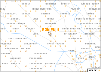
Bà Ðie18m (Hồ Chí Minh, Vietnam)Bà Ðie18m is a town in the Hồ Chí Minh region of Vietnam. An overview map of the region around Bà Ðie18m is displayed below.
regional and 3d topo map of Bà Ðie18m, Vietnam ::
Bà Ðie18m airports ::
The nearest airport is SGN - Ho Chi Minh City Tansonnhat Intl, located 22.0 km south east of Bà Ðie18m.
Other airports nearby include PNH - Phnom-penh Phnom Penh Intl (193.6 km west), Nearby towns ::
Ấp Miểu (0.0km north) //
Phước Vĩnh Ninh (1.8km east) //
Ấp Trùm Tri (1.9km north) //
Tân Thông (1.9km south) //
Ấp Bào Siêm (1.9km south) //
Vĩnh Cư (2.6km north east) //
Tân Phú Trung (2.6km south east) //
Xóm Phú Hiệp (3.7km north) //
Ấp Tiên (3.7km south) //
Ấp Bến Ðò (2) (4.1km south east) //
Ấp Trảng (4.1km north west) //
Ấp Giữa (5.2km south east) //
Ấp Trảng Lắm (1) (5.2km north west) //
Củ Chi (5.5km west) //
Phú Hộp (5.6km north) //
Bào Cạp (5.6km north) //
Tân Hòa (5.8km east) //
Ấp Ðồng Sao (5.8km east) //
Ấp Chợ (6.6km south east) //
Bào Chừa (6.6km north west) //
Ấp Trung Nhì (1) (7.3km east) //
Ấp Bàu Trâm (7.5km east) //
Bầu Tròn (7.6km north) //
Ấp Mũi Con (7.5km west) //
Phước Mỹ (7.5km west) //
Gia Be (7.8km north west) //
Xóm Bến Cỏ (8.3km north east) //
Xóm Lục Viên (1) (8.2km south west) //
Xóm Giồng Dầu (8.3km south west) //
[all distances 'as the bird flies' and approximate]  Places with similar names to Bà Ðie18m, Vietnam ::
// Butibum 1 (PG)
Disclaimer :: Information on this page comes without warranty of any kind |
||
|
Where is Bà Ðie18m? Elevation and coordinates ::
Latitude (lat): 10°58'0"N Longitude (lon): 106°31'0"E
Elevation (approx.): 10m (map arrows pan, magnifying glasses zoom) |
||
|
Visiting Bà Ðie18m? Hotel/Accommodation ::
Book a hotel in Bà Ðie18m Travel Guide ::
Buy a travel guide for Vietnam rental cars ::
car rental offers GPS waypoint ::
download a GPX waypoint (PoI) of Bà Ðie18m for your GPS receiver
|
||