|
search place name
|
||
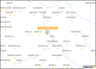
Bản Bom Kam (Sơn La, Vietnam)Bản Bom Kam is a town in the Sơn La region of Vietnam. An overview map of the region around Bản Bom Kam is displayed below.
regional and 3d topo map of Bản Bom Kam, Vietnam ::
Bản Bom Kam airports ::
The nearest airport is LPQ - Luang Prabang Luang Phabang Intl, located 205.9 km south west of Bản Bom Kam.
Nearby towns ::
Pa Ma (2.5km south east) //
Houei Tia (3.5km west) //
Bản Pha Hap (4.1km south east) //
Bản Co Mi (5.6km south) //
Bản Na La (5.6km north) //
Bản Sa Lan (5.8km south) //
Bản Pou Ha (6.5km south east) //
Pha Len (6.9km west) //
Sop Bam (7.6km north) //
Bo Xing (7.8km south east) //
Bản Can Ty (8.2km north east) //
Bản Fenh (9.0km north west) //
Bản Phung (10.1km south east) //
[all distances 'as the bird flies' and approximate] 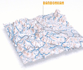 Places with similar names to Bản Bom Kam, Vietnam :: Disclaimer :: Information on this page comes without warranty of any kind |
||
|
Where is Bản Bom Kam? Elevation and coordinates ::
Latitude (lat): 21°20'0"N Longitude (lon): 103°25'0"E
Elevation (approx.): 561m (map arrows pan, magnifying glasses zoom) |
||
|
Visiting Bản Bom Kam? Hotel/Accommodation ::
Book a hotel in Bản Bom Kam Travel Guide ::
Buy a travel guide for Vietnam rental cars ::
car rental offers GPS waypoint ::
download a GPX waypoint (PoI) of Bản Bom Kam for your GPS receiver
|
||