|
search place name
|
||
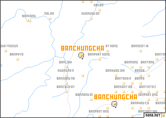
Bản Chung Cha (Lai Châu, Vietnam)Bản Chung Cha is a town in the Lai Châu region of Vietnam. An overview map of the region around Bản Chung Cha is displayed below.
regional and 3d topo map of Bản Chung Cha, Vietnam ::
Bản Chung Cha airports ::
The nearest airport is LPQ - Luang Prabang Luang Phabang Intl, located 208.3 km south west of Bản Chung Cha.
Nearby towns ::
Bản Sung Quan (3.7km south) //
Bản Pha Thong (3.4km east) //
Bản Linh (3.9km south west) //
Bản Pha Thong (3.9km north east) //
Muong Pon (5.1km south west) //
Bản Pha Thong (5.5km east) //
Bản Kang Na (6.5km south west) //
Bản Cochay (8.2km south west) //
Bản Hua Giôm (7.8km south east) //
Bản Na Cai (10.1km south east) //
[all distances 'as the bird flies' and approximate] 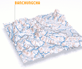 Places with similar names to Bản Chung Cha, Vietnam ::
// Ban Chang Chua (TH)
// Ban Ching Cho (TH)
// Ban Changcha (LA)
// Bản Chung Chải (VN)
// Bản Chung Cha (VN)
// Bản Chung Chái (VN)
Disclaimer :: Information on this page comes without warranty of any kind |
||
|
Where is Bản Chung Cha? Elevation and coordinates ::
Latitude (lat): 21°35'0"N Longitude (lon): 103°3'0"E
Elevation (approx.): 914m (map arrows pan, magnifying glasses zoom) |
||
|
Visiting Bản Chung Cha? Hotel/Accommodation ::
Book a hotel in Bản Chung Cha Travel Guide ::
Buy a travel guide for Vietnam rental cars ::
car rental offers GPS waypoint ::
download a GPX waypoint (PoI) of Bản Chung Cha for your GPS receiver
|
||