|
search place name
|
||
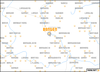
Bản Den (Vietnam)Bản Den is a town in Vietnam. An overview map of the region around Bản Den is displayed below.
regional and 3d topo map of Bản Den, Vietnam ::
Bản Den airports ::
The nearest airport is HAN - Hanoi Noibai Intl, located 120.6 km east of Bản Den.
Nearby towns ::
Bản Puc (1.7km east) //
Bản Muông (1.7km east) //
Bản Hua Nà (1.7km east) //
Bản Làn (1.9km north) //
Bản Ba Ngoa (2.5km south east) //
Bản Na Quang (2.5km north east) //
Bản Giân (2.5km north west) //
Bản Kháo (2.5km north west) //
Bản Pèo (3.9km south east) //
Tam Yonne (4.1km south east) //
Bản Khoa (2) (4.1km north west) //
Bản Xanh (5.1km south east) //
Bản Suối Dame (5.1km south east) //
Bản Lôm (5.2km east) //
Bản Pha Hao (5.2km east) //
Bản Suối Cối (5.8km south) //
Bản Khoa (1) (5.8km north) //
Sui Bung (5.8km north) //
Bản Suối (2) (6.4km south east) //
Nuôi Lac (6.5km north east) //
Bản Mùng (6.5km south east) //
Bản Lum Phoi (6.4km south west) //
Bản Suối Muon (7.4km south) //
Bản Băc Bán (7.6km south) //
Bản Ta Phô (7.6km south) //
Bản Ham (7.6km north) //
Gia Phù (7.6km north) //
Làng Bua (7.6km north) //
Làng Tiai (7.6km north) //
[all distances 'as the bird flies' and approximate] 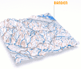 Places with similar names to Bản Den, Vietnam ::
Disclaimer :: Information on this page comes without warranty of any kind |
||
|
Where is Bản Den? Elevation and coordinates ::
Latitude (lat): 21°8'0"N Longitude (lon): 104°39'0"E
Elevation (approx.): 193m (map arrows pan, magnifying glasses zoom) |
||
|
Visiting Bản Den? Hotel/Accommodation ::
Book a hotel in Bản Den Travel Guide ::
Buy a travel guide for Vietnam rental cars ::
car rental offers GPS waypoint ::
download a GPX waypoint (PoI) of Bản Den for your GPS receiver
|
||