|
search place name
|
||
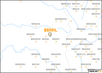
Ban Pil (Ðắc Lắk, Vietnam)Ban Pil is a town in the Ðắc Lắk region of Vietnam. An overview map of the region around Ban Pil is displayed below.
regional and 3d topo map of Ban Pil, Vietnam ::
Ban Pil airports ::
The nearest airport is NHA - Nhatrang, located 147.4 km south east of Ban Pil.
Nearby towns ::
Ban Kêt (1.8km west) //
Ban Muy (2.6km south east) //
Ban Hal (2.6km south west) //
Ban Brieng (5.8km north) //
Ban Drênh (5.7km west) //
Ban Dung (6.6km north west) //
Ban Tang Mlak (1) (6.6km north east) //
Buôn Brieng (6.6km north east) //
Ban K'dro (6.6km south east) //
Ban Khal (7.2km west) //
Ban Kdrao (7.5km east) //
Ban Drăng (7.6km south) //
Ban Ay Dlă (2) (9.1km north east) //
Ban Rong (9.2km south west) //
[all distances 'as the bird flies' and approximate]  Places with similar names to Ban Pil, Vietnam ::
// Ban Na Pla (TH)
// Ban Na Plai (TH)
// Ban Pala (TH)
// Ban Pa Laeo (TH)
// Ban Pa Lao (TH)
// Ban Pa Lao (TH)
// Ban Pa Lao (TH)
// Ban Pa Lao (TH)
// Ban Pa Lao (TH)
// Ban Pa Lao (TH)
Disclaimer :: Information on this page comes without warranty of any kind |
||
|
Where is Ban Pil? Elevation and coordinates ::
Latitude (lat): 13°6'0"N Longitude (lon): 108°10'0"E
Elevation (approx.): 626m (map arrows pan, magnifying glasses zoom) |
||
|
Visiting Ban Pil? Hotel/Accommodation ::
Book a hotel in Ban Pil Travel Guide ::
Buy a travel guide for Vietnam rental cars ::
car rental offers GPS waypoint ::
download a GPX waypoint (PoI) of Ban Pil for your GPS receiver
|
||