|
search place name
|
||
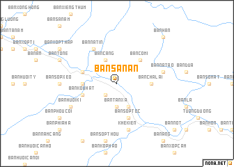
Bản Sa Nan (Vietnam)Bản Sa Nan is a town in Vietnam. An overview map of the region around Bản Sa Nan is displayed below.
regional and 3d topo map of Bản Sa Nan, Vietnam ::
Bản Sa Nan airports ::
The nearest airport is VTE - Vientiane Wattay Intl, located 237.5 km south west of Bản Sa Nan.
Other airports nearby include HAN - Hanoi Noibai Intl (260.6 km north east), UTH - Udon Thani (269.3 km south west), Nearby towns ::
Bản Ca Tang (2.5km south west) //
Bản Nhan Dong (2.5km south west) //
Bản Tan Xà (3.7km south) //
Bản Huôi Cui (3.7km south) //
Bản Sop Huôi Cui (4.1km south east) //
Bản Cang (4.1km north west) //
Bản Co Mi (5.1km north east) //
Bản Cha Lai (5.2km east) //
Bản Piêng Cu (5.2km west) //
Bản Kou Hat (5.6km west) //
Bản Sop Toc (5.8km south) //
Bản Ca Nan (5.6km west) //
Bản Mường Thù (5.6km west) //
Bản Long (5.6km west) //
Bản Na Tin (6.6km north west) //
Khê Kiên (7.6km south) //
Bản Mơ (7.2km east) //
Bản Chàm Puông (7.2km east) //
Bản Na Tao (7.2km east) //
Bản Huôi Ki (7.9km south west) //
Bản Han (10.2km north east) //
[all distances 'as the bird flies' and approximate] 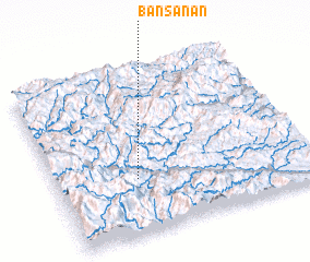 Places with similar names to Bản Sa Nan, Vietnam ::
// Ban Na Sanuan (TH)
// Ban Na Sanun (TH)
// Ban Na Sao Nan (TH)
// Ban Na Si Nuan (TH)
// Ban Na Si Nuan (TH)
// Ban Na Si Nuan (TH)
// Ban Na Si Nuan (TH)
// Ban Na Si Nuan (TH)
// Ban Na Si Nuan (TH)
// Ban Na Si Nuan (TH)
Disclaimer :: Information on this page comes without warranty of any kind |
||
|
Where is Bản Sa Nan? Elevation and coordinates ::
Latitude (lat): 19°20'0"N Longitude (lon): 104°19'0"E
Elevation (approx.): 165m (map arrows pan, magnifying glasses zoom) |
||
|
Visiting Bản Sa Nan? Hotel/Accommodation ::
Book a hotel in Bản Sa Nan Travel Guide ::
Buy a travel guide for Vietnam rental cars ::
car rental offers GPS waypoint ::
download a GPX waypoint (PoI) of Bản Sa Nan for your GPS receiver
|
||