|
search place name
|
||
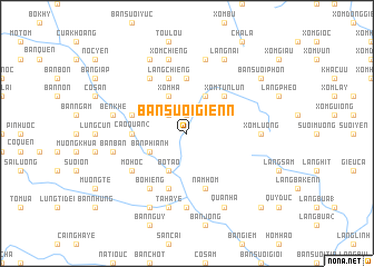
Bản Suối Gienn (Vietnam)Bản Suối Gienn is a town in Vietnam. An overview map of the region around Bản Suối Gienn is displayed below.
regional and 3d topo map of Bản Suối Gienn, Vietnam ::
Bản Suối Gienn airports ::
The nearest airport is HAN - Hanoi Noibai Intl, located 90.7 km east of Bản Suối Gienn.
Nearby towns ::
Làng Nhap (1.9km north) //
Xóm Komit (1.9km north) //
Làng Chum (2.5km north west) //
Bô Tao (4.1km south west) //
Làng Nhap Ngoai (4.1km south west) //
Xóm Ha (4.1km north west) //
Bản Phianh (3.9km south west) //
Bản Suối Nhon (4.1km north east) //
Xóm Tun Lun (5.1km north east) //
Bản Suối Bon (5.1km north east) //
Cao Quan (2) (5.2km west) //
Bản Suối Duon (5.6km north) //
Làng Chiêng (5.8km north) //
Na Baye Ngoai (5.8km south) //
An Miêng (5.8km south) //
Bản Chanh (5.5km west) //
Nam Hom (5.8km south) //
Dong Ruong (5.8km south) //
Mô Hóc (6.4km south west) //
Lung Nin (6.4km south west) //
Bo Hiêng (6.5km south west) //
Bản Suối An (6.5km north west) //
Bản Bò (6.5km south west) //
Hang Miêng (7.4km south) //
Xóm Luong (6.9km east) //
Bản Ban (7.2km west) //
Lung Liên (7.2km west) //
Ben Khê (7.2km west) //
Chiêng Cang (7.6km north) //
[all distances 'as the bird flies' and approximate] 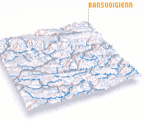 Places with similar names to Bản Suối Gienn, Vietnam ::
// Binzgen (DE)
// Bản Suối Gian (VN)
Disclaimer :: Information on this page comes without warranty of any kind |
||
|
Where is Bản Suối Gienn? Elevation and coordinates ::
Latitude (lat): 20°57'0"N Longitude (lon): 104°59'0"E
Elevation (approx.): 408m (map arrows pan, magnifying glasses zoom) |
||
|
Visiting Bản Suối Gienn? Hotel/Accommodation ::
Book a hotel in Bản Suối Gienn Travel Guide ::
Buy a travel guide for Vietnam rental cars ::
car rental offers GPS waypoint ::
download a GPX waypoint (PoI) of Bản Suối Gienn for your GPS receiver
|
||