|
search place name
|
||
Bản Tsa Nam Meng (Lai Châu, Vietnam)Bản Tsa Nam Meng is a town in the Lai Châu region of Vietnam. An overview map of the region around Bản Tsa Nam Meng is displayed below.
regional and 3d topo map of Bản Tsa Nam Meng, Vietnam ::
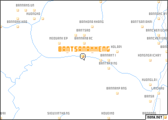
Nearby towns ::
Bản Nam Yon (2.5km north east) //
Bản Ðup Ngu (3.4km east) //
Bản Nam Bac (3.7km north) //
Bản Houei Sư (3.7km north) //
Bản Nằm Nhun (3.9km north west) //
Bản Tsa Houei Nan (3.9km north west) //
Bản Nam Ti (5.2km east) //
Bản Tsa Ơ (5.6km north) //
Bản Ta Fang (5.5km east) //
Bản Nằm Cay (5.8km north) //
Mèo Ðan Kép (6.3km north west) //
Ho La Pi (7.1km east) //
Bản Hô Nam Hang (7.6km north) //
Bản Nam Pang (10.1km south east) //
[all distances 'as the bird flies' and approximate] 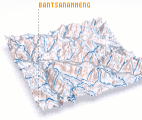 Places with similar names to Bản Tsa Nam Meng, Vietnam :: Disclaimer :: Information on this page comes without warranty of any kind |
||
|
Where is Bản Tsa Nam Meng? Elevation and coordinates ::
Latitude (lat): 22°8'0"N Longitude (lon): 103°1'0"E
Elevation (approx.): 277m (map arrows pan, magnifying glasses zoom) |
||
|
Visiting Bản Tsa Nam Meng? Hotel/Accommodation ::
Book a hotel in Bản Tsa Nam Meng Travel Guide ::
Buy a travel guide for Vietnam rental cars ::
car rental offers GPS waypoint ::
download a GPX waypoint (PoI) of Bản Tsa Nam Meng for your GPS receiver
|
||