|
search place name
|
||
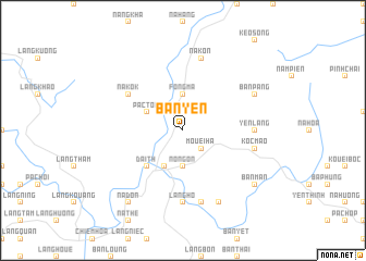
Bản Yen (Vietnam)Bản Yen is a town in Vietnam. An overview map of the region around Bản Yen is displayed below.
regional and 3d topo map of Bản Yen, Vietnam ::
Bản Yen airports ::
The nearest airport is HAN - Hanoi Noibai Intl, located 122.7 km south of Bản Yen.
Nearby towns ::
Mouei Ha (2.5km south east) //
Nong On (3.7km south) //
Fong Ma (3.7km north) //
Na Mo (4.1km south west) //
Pac Tou (3.9km north west) //
Ðài Th (5.1km south west) //
Nà Kok (6.3km north west) //
Yên Lãng (6.9km east) //
Làng Ho (7.4km south) //
Làng Hen (7.4km south) //
Koc Mao (7.1km east) //
Na Kon (7.6km north) //
Làng Douc (7.6km south) //
Bản Pang (7.8km north east) //
Khouen Kuong (8.2km south east) //
Bản Man (8.8km south east) //
Nà Don (9.0km south west) //
[all distances 'as the bird flies' and approximate] 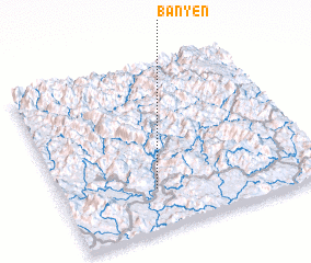 Places with similar names to Bản Yen, Vietnam ::
Disclaimer :: Information on this page comes without warranty of any kind |
||
|
Where is Bản Yen? Elevation and coordinates ::
Latitude (lat): 22°15'0"N Longitude (lon): 105°22'0"E
Elevation (approx.): 273m (map arrows pan, magnifying glasses zoom) |
||
|
Visiting Bản Yen? Hotel/Accommodation ::
Book a hotel in Bản Yen Travel Guide ::
Buy a travel guide for Vietnam rental cars ::
car rental offers GPS waypoint ::
download a GPX waypoint (PoI) of Bản Yen for your GPS receiver
|
||