|
search place name
|
||
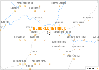
Blao Klong Trao (2) (Lâm Ðồng, Vietnam)Blao Klong Trao (2) is a town in the Lâm Ðồng region of Vietnam. An overview map of the region around Blao Klong Trao (2) is displayed below.
regional and 3d topo map of Blao Klong Trao (2), Vietnam ::
Blao Klong Trao (2) airports ::
The nearest airport is SGN - Ho Chi Minh City Tansonnhat Intl, located 119.4 km south west of Blao Klong Trao (2).
Other airports nearby include NHA - Nhatrang (198.7 km north east), Nearby towns ::
Chi Lập (2) (1.9km north) //
Dang Wang (2.6km south west) //
Dör Da Wang (3.6km east) //
Blao Klong Ner (4.1km north east) //
Buôn Ké Blang (4.1km north east) //
Bon Kon Ha Dang (5.2km south east) //
Da Jrang (5.2km north east) //
Madagui (5.5km west) //
Buôn S'ran (5.8km west) //
Da Hòa (5.8km east) //
Bo Kocil (6.6km north west) //
Bon Ko R'pung (2) (6.6km south east) //
B'sar (7.3km east) //
Totkat (7.5km west) //
Buôn B'ké (9.2km south east) //
Romo (9.2km south west) //
Phú Lâm (10.4km south west) //
Bon Dô (10.4km south east) //
[all distances 'as the bird flies' and approximate] 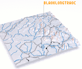 Places with similar names to Blao Klong Trao (2), Vietnam :: Disclaimer :: Information on this page comes without warranty of any kind |
||
|
Where is Blao Klong Trao (2)? Elevation and coordinates ::
Latitude (lat): 11°23'0"N Longitude (lon): 107°35'0"E
Elevation (approx.): 361m (map arrows pan, magnifying glasses zoom) |
||
|
Visiting Blao Klong Trao (2)? Hotel/Accommodation ::
Book a hotel in Blao Klong Trao (2) Travel Guide ::
Buy a travel guide for Vietnam rental cars ::
car rental offers GPS waypoint ::
download a GPX waypoint (PoI) of Blao Klong Trao (2) for your GPS receiver
|
||