|
search place name
|
||
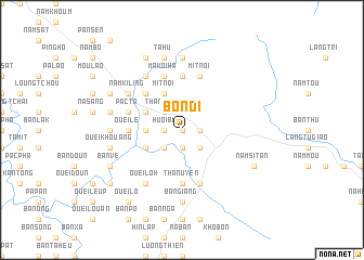
Bôn Di (Vietnam)Bôn Di is a town in Vietnam. An overview map of the region around Bôn Di is displayed below.
regional and 3d topo map of Bôn Di, Vietnam ::
Bôn Di airports ::
The nearest airport is HAN - Hanoi Noibai Intl, located 217.7 km south east of Bôn Di.
Nearby towns ::
Luong Khi (0.0km north) //
Nậm Vai (1.7km east) //
Huổi Bí (1.7km west) //
Luong Noi (1.7km west) //
Nam Sang (1.9km south) //
Nam Bai (2.5km south east) //
Bản La Sout (2.5km south east) //
Làng Ngụa (2.5km south east) //
Thanh Sơn (2.5km north west) //
Sa Ngà (2.5km south west) //
Hoàng Hà (3.4km west) //
Huei Nam (3.4km west) //
Mít Noi (4.1km north west) //
Ouei San (3.9km north west) //
Ha Nam (3.9km south west) //
Bản Toun (5.1km north west) //
Cang Ban (5.1km north west) //
Ouei Lan (5.6km south) //
Bản Lan (5.6km south) //
Ho Mit (5.6km north) //
Than Uyên (5.6km south) //
Ouei Lan (5.2km west) //
Hát Nam (5.2km west) //
Ouei Le (5.2km west) //
Nà Phát (5.8km south) //
Mít Nọi (5.8km north) //
Hua Pù (5.8km north) //
Bản Lầu (5.8km north) //
Ma Koi Ha (5.8km north) //
[all distances 'as the bird flies' and approximate] 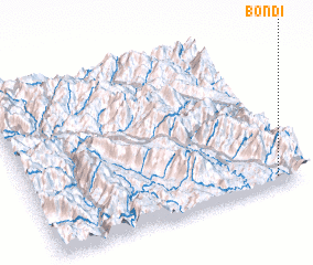 Places with similar names to Bôn Di, Vietnam ::
Disclaimer :: Information on this page comes without warranty of any kind |
||
|
Where is Bôn Di? Elevation and coordinates ::
Latitude (lat): 22°3'0"N Longitude (lon): 103°54'0"E
Elevation (approx.): 648m (map arrows pan, magnifying glasses zoom) |
||
|
Visiting Bôn Di? Hotel/Accommodation ::
Book a hotel in Bôn Di Travel Guide ::
Buy a travel guide for Vietnam rental cars ::
car rental offers GPS waypoint ::
download a GPX waypoint (PoI) of Bôn Di for your GPS receiver
|
||