|
search place name
|
||
Buôn Méra (Quảng Nam-Ðà Nẵng, Vietnam)Buôn Méra is a town in the Quảng Nam-Ðà Nẵng region of Vietnam. An overview map of the region around Buôn Méra is displayed below.
regional and 3d topo map of Buôn Méra, Vietnam ::

Buôn Méra airports ::
The nearest airport is SGN - Ho Chi Minh City Tansonnhat Intl, located 174.4 km south west of Buôn Méra.
Other airports nearby include NHA - Nhatrang (175.7 km east), Nearby towns ::
Buôn Bu N'doh (1.9km south) //
Bu Jeng Giat (2.6km north west) //
Buôn N'drung Ja (1) (4.1km south east) //
Buôn Bong Ding (5.4km east) //
Buôn N'drung Ja (2) (5.8km south) //
Buôn Buk So (2) (8.3km south west) //
Bon Jang Plei (9.1km north east) //
Buôn Bu M'bré (9.2km south west) //
Ấp Tâm Hưng (10.4km south west) //
[all distances 'as the bird flies' and approximate] 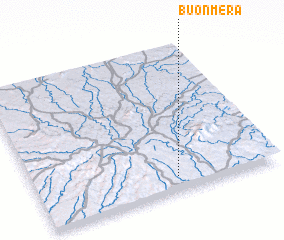 Places with similar names to Buôn Méra, Vietnam ::
// Beni Amar (MA)
// Ben Aomar (MA)
// Binumar (MA)
// Ban Mae Rai (TH)
// Ban Mai Ra (TH)
// Ban Mari (TH)
// Ban Marui (TH)
// Ban Merai (TH)
// Ban Mi Rai (TH)
// Ban Nam Rai (TH)
Disclaimer :: Information on this page comes without warranty of any kind |
||
|
Where is Buôn Méra? Elevation and coordinates ::
Latitude (lat): 12°6'0"N Longitude (lon): 107°35'0"E
Elevation (approx.): 777m (map arrows pan, magnifying glasses zoom) |
||
|
Visiting Buôn Méra? Hotel/Accommodation ::
Book a hotel in Buôn Méra Travel Guide ::
Buy a travel guide for Vietnam rental cars ::
car rental offers GPS waypoint ::
download a GPX waypoint (PoI) of Buôn Méra for your GPS receiver
|
||