|
search place name
|
||
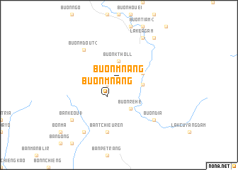
Buôn Mnang (Ðắc Lắk, Vietnam)Buôn Mnang is a town in the Ðắc Lắk region of Vietnam. An overview map of the region around Buôn Mnang is displayed below.
regional and 3d topo map of Buôn Mnang, Vietnam ::
Buôn Mnang airports ::
The nearest airport is NHA - Nhatrang, located 74.2 km east of Buôn Mnang.
Other airports nearby include SGN - Ho Chi Minh City Tansonnhat Intl (269.6 km south west), Nearby towns ::
Buôn R'hang (1.8km west) //
Buôn Mnang (2.6km south west) //
Buôn K'tholl (3.7km north) //
Buôn Khoueng (3.6km east) //
Buôn Rê Hê (4.1km south east) //
Buôn Ea Chau (4.1km north east) //
Ban Tchieuren (7.6km south) //
Buôn M'dout (2) (7.8km north west) //
Buôn Dia (7.8km south east) //
Lak Ea Gam (8.2km north east) //
Ban Kêou (1) (9.1km south west) //
Ban Kêou (2) (9.2km south west) //
Buôn Ê Gui (9.2km north east) //
[all distances 'as the bird flies' and approximate]  Places with similar names to Buôn Mnang, Vietnam ::
// Ban Mae Nang (TH)
// Ban Mae Nong (TH)
// Ban Manang (LA)
// Ban M'nang (VN)
// Ban Ma Nung (VN)
// Buôn Mnang (VN)
Disclaimer :: Information on this page comes without warranty of any kind |
||
|
Where is Buôn Mnang? Elevation and coordinates ::
Latitude (lat): 12°24'0"N Longitude (lon): 108°32'0"E
Elevation (approx.): 668m (map arrows pan, magnifying glasses zoom) |
||
|
Visiting Buôn Mnang? Hotel/Accommodation ::
Book a hotel in Buôn Mnang Travel Guide ::
Buy a travel guide for Vietnam rental cars ::
car rental offers GPS waypoint ::
download a GPX waypoint (PoI) of Buôn Mnang for your GPS receiver
|
||