|
search place name
|
||
Cha Lỳ (Vietnam)Cha Lỳ is a town in Vietnam. An overview map of the region around Cha Lỳ is displayed below.
regional and 3d topo map of Cha Lỳ, Vietnam ::

Cha Lỳ airports ::
The nearest airport is ZVK - Savannakhet, located 196.1 km west of Cha Lỳ.
Other airports nearby include DAD - Danang Intl (197.5 km south east), PKZ - Pakse (211.2 km south west), Nearby towns ::
Ban A Choc (1.8km east) //
Ban Tchèpone (1.9km north) //
Ta Pương (2.6km south east) //
Làng Tria (3.5km east) //
Ban Trim (3.5km west) //
Ban Kapay (2) (3.5km west) //
Ban Tapang (4.0km north west) //
Ban Apok (5.1km south west) //
Ban Taha (5.1km south west) //
Ban Kapay (1) (5.3km west) //
Kho Cha (5.6km east) //
Ban Taklak (5.8km south) //
Ban Tang A (6.5km south west) //
Ban Tapoy (6.5km north west) //
Ban Karak (6.6km south west) //
Ban Tariak (1) (7.1km west) //
Ban Taroun (7.6km south) //
Veng Khuch (7.3km east) //
Ban Klou (9.1km south west) //
Ban Saria (9.0km north west) //
[all distances 'as the bird flies' and approximate] 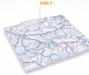 Places with similar names to Cha Lỳ, Vietnam ::
Disclaimer :: Information on this page comes without warranty of any kind |
||
|
Where is Cha Lỳ? Elevation and coordinates ::
Latitude (lat): 16°53'0"N Longitude (lon): 106°34'0"E
Elevation (approx.): 452m (map arrows pan, magnifying glasses zoom) |
||
|
Visiting Cha Lỳ? Hotel/Accommodation ::
Book a hotel in Cha Lỳ Travel Guide ::
Buy a travel guide for Vietnam rental cars ::
car rental offers GPS waypoint ::
download a GPX waypoint (PoI) of Cha Lỳ for your GPS receiver
|
||