|
search place name
|
||
Côn Sơn (Thanh Hóa, Vietnam)Côn Sơn is a town in the Thanh Hóa region of Vietnam. An overview map of the region around Côn Sơn is displayed below.
regional and 3d topo map of Côn Sơn, Vietnam ::

Côn Sơn airports ::
The nearest airport is HAN - Hanoi Noibai Intl, located 167.1 km north of Côn Sơn.
Nearby towns ::
Sơn Lương (1.9km north) //
Yên Mô (1.7km west) //
Ðông Bàng Thượng (1.7km west) //
Thiên Linh Ðoài (1.7km west) //
Bái Ðao (1.7km east) //
Hồi Cù (1.7km east) //
Nông Cống (1.9km south) //
Cầu Nhơn (2.5km north west) //
Thỏ Ngọc (2.5km north east) //
Yên Thái (2.5km north east) //
Thổ Ngõa (2.5km south east) //
Thanh Tháp (3.7km south) //
Lương Ðịnh (4.0km north west) //
Hoang Lạp (4.1km north east) //
Tân Phong (4.1km north east) //
Thiên Linh Ðông (4.0km north east) //
Thổ Vi (4.1km south west) //
Thịnh Lạc (4.1km south east) //
Xuân Bảng (4.1km south east) //
Quả Cẩm (4.1km south east) //
Cổ Ðịnh (5.1km north west) //
Thach Thât (5.1km north east) //
Lam Cầu (5.1km south east) //
Côn Cương (5.6km south) //
Mai Chử (5.6km east) //
Mỹ Phong (5.6km west) //
Doãn Thái (5.8km north) //
Lộc Long (5.6km east) //
Quan Hoạch (5.8km south) //
[all distances 'as the bird flies' and approximate] 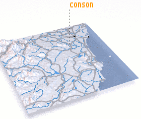 Places with similar names to Côn Sơn, Vietnam ::
Disclaimer :: Information on this page comes without warranty of any kind |
||
|
Where is Côn Sơn? Elevation and coordinates ::
Latitude (lat): 19°43'0"N Longitude (lon): 105°41'0"E
Elevation (approx.): 3m (map arrows pan, magnifying glasses zoom) |
||
|
Visiting Côn Sơn? Hotel/Accommodation ::
Book a hotel in Côn Sơn Travel Guide ::
Buy a travel guide for Vietnam rental cars ::
car rental offers GPS waypoint ::
download a GPX waypoint (PoI) of Côn Sơn for your GPS receiver
|
||