|
search place name
|
||
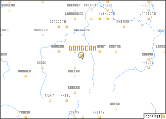
Ðồng Cầm (Quảng Ninh, Vietnam)Ðồng Cầm is a town in the Quảng Ninh region of Vietnam. An overview map of the region around Ðồng Cầm is displayed below.
regional and 3d topo map of Ðồng Cầm, Vietnam ::
Ðồng Cầm airports ::
The nearest airport is HAN - Hanoi Noibai Intl, located 134.2 km west of Ðồng Cầm.
Other airports nearby include NNG - Nanning Wuxu (189.8 km north east), Nearby towns ::
Ðồng Oanh (2.5km north west) //
Khê Mộc (2.5km south west) //
Ðồng Kiệt (3.9km north east) //
Khê Càn (4.1km south west) //
Pắc Ðoang (5.6km north) //
Minh Cầm (5.5km west) //
Khê Dám (5.5km west) //
Khê Tre (7.2km east) //
Khê Chó (7.6km south) //
Bằng Chức (8.2km north west) //
Dong Gong (9.0km north west) //
[all distances 'as the bird flies' and approximate] 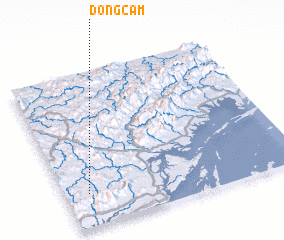 Places with similar names to Ðồng Cầm, Vietnam ::
// Dongo-Kuma (CD)
// Tingkem (ID)
// Tingkeum (ID)
// Tingkeum (ID)
// Tounga Koma (NE)
// Dinkakoma (GN)
// Tunga Gumai (NG)
// Tangk'ŭmae (KR)
// Tengkim (PG)
// Dong Cam (VN)
Disclaimer :: Information on this page comes without warranty of any kind |
||
|
Where is Ðồng Cầm? Elevation and coordinates ::
Latitude (lat): 21°13'0"N Longitude (lon): 107°6'0"E
Elevation (approx.): 198m (map arrows pan, magnifying glasses zoom) |
||
|
Visiting Ðồng Cầm? Hotel/Accommodation ::
Book a hotel in Ðồng Cầm Travel Guide ::
Buy a travel guide for Vietnam rental cars ::
car rental offers GPS waypoint ::
download a GPX waypoint (PoI) of Ðồng Cầm for your GPS receiver
|
||