|
search place name
|
||
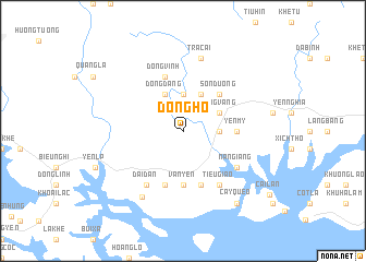
Ðông Hô (Quảng Ninh, Vietnam)Ðông Hô is a town in the Quảng Ninh region of Vietnam. An overview map of the region around Ðông Hô is displayed below.
regional and 3d topo map of Ðông Hô, Vietnam ::
Ðông Hô airports ::
The nearest airport is HAN - Hanoi Noibai Intl, located 122.2 km west of Ðông Hô.
Other airports nearby include NNG - Nanning Wuxu (214.4 km north east), Nearby towns ::
Xu Pau (3.5km east) //
Dong Giang (3.7km north) //
Ðong Vang (3.9km north east) //
Cây Thi (4.1km north east) //
Dong Dang (4.1km north west) //
Sơn Dương (5.1km north east) //
Yên Mỹ (5.2km east) //
Hoành Sơn (5.6km south) //
Vạn Yên (5.6km south) //
Dong Dang (5.8km south) //
Nghủa Lô (5.8km south) //
Ðông Vinh (5.8km north) //
An Thiếm (6.5km south east) //
Tiêu Giao (6.5km south east) //
Nan Giang (6.4km south east) //
Ðại Ðán (6.5km south west) //
Tra Cài (7.6km north) //
Yên Cư (7.8km south west) //
Cây Quéo (9.0km south east) //
[all distances 'as the bird flies' and approximate] 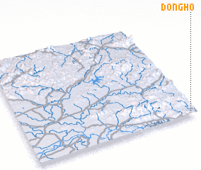 Places with similar names to Ðông Hô, Vietnam ::
Disclaimer :: Information on this page comes without warranty of any kind |
||
|
Where is Ðông Hô? Elevation and coordinates ::
Latitude (lat): 21°2'0"N Longitude (lon): 106°58'0"E
Elevation (approx.): 145m (map arrows pan, magnifying glasses zoom) |
||
|
Visiting Ðông Hô? Hotel/Accommodation ::
Book a hotel in Ðông Hô Travel Guide ::
Buy a travel guide for Vietnam rental cars ::
car rental offers GPS waypoint ::
download a GPX waypoint (PoI) of Ðông Hô for your GPS receiver
|
||