|
search place name
|
||
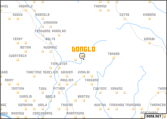
Ðông Lỗ (Vĩnh Phú, Vietnam)Ðông Lỗ is a town in the Vĩnh Phú region of Vietnam. An overview map of the region around Ðông Lỗ is displayed below.
regional and 3d topo map of Ðông Lỗ, Vietnam ::
Ðông Lỗ airports ::
The nearest airport is HAN - Hanoi Noibai Intl, located 34.4 km south east of Ðông Lỗ.
Nearby towns ::
Sơn Ðình (1.7km west) //
Vinh Lai (3.7km south) //
Làng Hạ (4.1km south east) //
Ðại Ðiền (5.1km south west) //
Làng Sênh (5.8km south) //
Thê Ðồng (5.8km south) //
Tĩnh Luyện (5.5km west) //
Liên Hộ (5.5km west) //
Phù Liễn (6.5km south west) //
Tam Ðảo (6.3km east) //
Liễn Sơn (7.1km west) //
Hữu Phúc (7.1km west) //
Làng Ðêi (7.6km south west) //
Phan Lân (7.6km north west) //
Ngọc Liễn (7.8km south west) //
Bắc Bình (7.8km north west) //
Bồ Lý (1) (7.8km north west) //
Cửu Yên (2) (8.2km south east) //
Mỹ Thôn (9.0km south west) //
Vĩnh Ninh (10.1km north west) //
Xạ Hưng (10.1km south east) //
[all distances 'as the bird flies' and approximate] 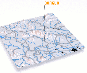 Places with similar names to Ðông Lỗ, Vietnam ::
Disclaimer :: Information on this page comes without warranty of any kind |
||
|
Where is Ðông Lỗ? Elevation and coordinates ::
Latitude (lat): 21°27'0"N Longitude (lon): 105°35'0"E
Elevation (approx.): 55m (map arrows pan, magnifying glasses zoom) |
||
|
Visiting Ðông Lỗ? Hotel/Accommodation ::
Book a hotel in Ðông Lỗ Travel Guide ::
Buy a travel guide for Vietnam rental cars ::
car rental offers GPS waypoint ::
download a GPX waypoint (PoI) of Ðông Lỗ for your GPS receiver
|
||