|
search place name
|
||
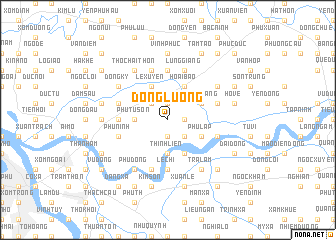
Ðồng Lượng (Hà Bắc, Vietnam)Ðồng Lượng is a town in the Hà Bắc region of Vietnam. An overview map of the region around Ðồng Lượng is displayed below.
regional and 3d topo map of Ðồng Lượng, Vietnam ::
Ðồng Lượng airports ::
The nearest airport is HAN - Hanoi Noibai Intl, located 24.1 km north west of Ðồng Lượng.
Nearby towns ::
Dưỡng Mông (1.9km north) //
Vằn Trinh (1.7km east) //
Ðại Vi (1.9km south) //
Ðại Sơn (2.5km north west) //
Phù Lưu (2.5km north west) //
Phật Tích (2.5km south east) //
Ðại Dính (3.5km west) //
Phủ Từ Sơn (3.5km west) //
Thịnh Liên (3.7km south) //
Hiên Ngang (3.9km north east) //
Hoài Bão Thượng (3.9km north east) //
Phù Lập (3.9km south east) //
Hoài Bão (4.1km north east) //
Lễ Xuyên (4.1km north west) //
Ðình Tổ (4.1km south east) //
Hồi Quan (5.6km north) //
Dinh Bàng (5.2km west) //
Lệ Chi (5.6km south) //
Chung Nam (5.5km east) //
Bình Ha (5.5km west) //
Lũng Giang (5.8km north) //
Phù Ninh (5.5km west) //
Nghĩa Chỉ (5.5km east) //
Phúc Tinh (5.8km north) //
Ðổng Viên (5.8km south) //
Tho Chai Thôn (6.5km north west) //
Ðồng Ky (6.4km north west) //
Bái Uyên (6.4km north east) //
Phù Ðổng (6.5km south west) //
[all distances 'as the bird flies' and approximate] 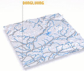 Places with similar names to Ðồng Lượng, Vietnam ::
// Teng Leng (MM)
// Dengling (DE)
// Tengling (DE)
// Dong Luang (TH)
// Tanglongo (BF)
// Tankoulounga (BF)
// Dang-Lang (CF)
// Tangalanga (NG)
// Tong Long (LA)
// Tenggelanga (ID)
Disclaimer :: Information on this page comes without warranty of any kind |
||
|
Where is Ðồng Lượng? Elevation and coordinates ::
Latitude (lat): 21°6'0"N Longitude (lon): 106°0'0"E
Elevation (approx.): 2m (map arrows pan, magnifying glasses zoom) |
||
|
Visiting Ðồng Lượng? Hotel/Accommodation ::
Book a hotel in Ðồng Lượng Travel Guide ::
Buy a travel guide for Vietnam rental cars ::
car rental offers GPS waypoint ::
download a GPX waypoint (PoI) of Ðồng Lượng for your GPS receiver
|
||