|
search place name
|
||
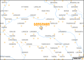
Ðồng Nhân (Vietnam)Ðồng Nhân is a town in Vietnam. An overview map of the region around Ðồng Nhân is displayed below.
regional and 3d topo map of Ðồng Nhân, Vietnam ::
Ðồng Nhân airports ::
The nearest airport is HAN - Hanoi Noibai Intl, located 86.3 km north of Ðồng Nhân.
Nearby towns ::
Chong Khan (2.5km north west) //
Xóm Muc (2.5km north east) //
Xóm Bén (2.5km north east) //
Chiêm Hóa (2.5km north east) //
Làng Bea (3.9km south west) //
Bỉnh Chân (3.9km south west) //
Dâm Hông (4.1km south west) //
Làng Kẽ Xó (5.1km north east) //
Ða Phúc (5.1km south west) //
Thượng Lũng (5.1km south east) //
Sông Léo (5.5km east) //
Dông Xói (5.8km north) //
Làng Bai Cả (5.5km east) //
Xao Vót (6.6km north west) //
Hiệu Lũng (6.4km south east) //
Lạc Thô (7.4km south) //
Ngọc Trạc (7.6km north) //
Làng Luông (7.6km north) //
Làng Côi (7.2km west) //
Lạc Thủy (7.6km south) //
Thôn Chiêm (7.6km south) //
Bình Hiểm (7.9km north west) //
Chá Ðang (7.9km north east) //
Xóm Giam (8.9km south west) //
Xóm Ðam (9.1km south west) //
Thôn Thôi (10.2km south east) //
[all distances 'as the bird flies' and approximate] 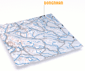 Places with similar names to Ðồng Nhân, Vietnam ::
// Tanguanhana (MZ)
// Ðông Nhân (VN)
// Ðồng Nhân (VN)
// Ðồng Nhân (VN)
// Ðồng Nhân (VN)
// Dóng Nhân (VN)
// Ðông Nhơn (VN)
// Ðương Nhân (VN)
Disclaimer :: Information on this page comes without warranty of any kind |
||
|
Where is Ðồng Nhân? Elevation and coordinates ::
Latitude (lat): 20°28'0"N Longitude (lon): 105°36'0"E
Elevation (approx.): 98m (map arrows pan, magnifying glasses zoom) |
||
|
Visiting Ðồng Nhân? Hotel/Accommodation ::
Book a hotel in Ðồng Nhân Travel Guide ::
Buy a travel guide for Vietnam rental cars ::
car rental offers GPS waypoint ::
download a GPX waypoint (PoI) of Ðồng Nhân for your GPS receiver
|
||