|
search place name
|
||
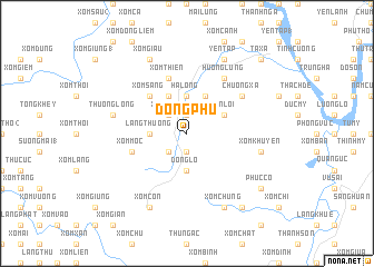
Ðồng Phú (Vĩnh Phú, Vietnam)Ðồng Phú is a town in the Vĩnh Phú region of Vietnam. An overview map of the region around Ðồng Phú is displayed below.
regional and 3d topo map of Ðồng Phú, Vietnam ::
Ðồng Phú airports ::
The nearest airport is HAN - Hanoi Noibai Intl, located 77.6 km east of Ðồng Phú.
Nearby towns ::
Ðồng Dân (1.9km north) //
Xóm Ðoai (1) (1.9km south) //
Xóm Cảy (3) (2.5km north west) //
Xóm Ðống (2.5km south west) //
Hạ Long (3.7km north) //
Ðông Lỗ (3.7km south) //
Ðồng Ðình (3.7km south) //
Làng Thượng (3.5km west) //
Sơn Lôi (3.9km north east) //
Ðồng Lạc (4.1km north east) //
Ngã Hai (4.1km north west) //
Xóm Sàng (5.1km north west) //
Xóm Mọc (5.5km west) //
Xóm Thiên (5.8km north) //
Xóm Mu (5.8km north) //
Hương Lung (6.5km north east) //
Chương Xá (6.4km north east) //
Xóm Khuyên (7.2km east) //
Thượng Long (7.2km west) //
Yên Tập (8.2km north east) //
Xóm Giâu (8.2km north west) //
Xóm Chung (8.2km south east) //
Xóm Con (8.2km south west) //
Phục Cổ (8.9km south east) //
Ngọc Lập (9.0km south east) //
Ta Xá (10.1km north east) //
[all distances 'as the bird flies' and approximate]  Places with similar names to Ðồng Phú, Vietnam ::
Disclaimer :: Information on this page comes without warranty of any kind |
||
|
Where is Ðồng Phú? Elevation and coordinates ::
Latitude (lat): 21°19'0"N Longitude (lon): 105°4'0"E
Elevation (approx.): 110m (map arrows pan, magnifying glasses zoom) |
||
|
Visiting Ðồng Phú? Hotel/Accommodation ::
Book a hotel in Ðồng Phú Travel Guide ::
Buy a travel guide for Vietnam rental cars ::
car rental offers GPS waypoint ::
download a GPX waypoint (PoI) of Ðồng Phú for your GPS receiver
|
||