|
search place name
|
||
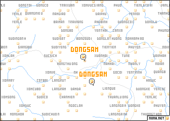
Ðông Sầm (Vietnam)Ðông Sầm is a town in Vietnam. An overview map of the region around Ðông Sầm is displayed below.
regional and 3d topo map of Ðông Sầm, Vietnam ::
Ðông Sầm airports ::
The nearest airport is HAN - Hanoi Noibai Intl, located 44.5 km north east of Ðông Sầm.
Nearby towns ::
Ðồng Gội (0.0km north) //
Quất Lâm (2.5km north west) //
Nhuận Trạch (3.7km south) //
Bóng Suối (3.7km north) //
Xuân Mai (3.5km east) //
Mông Thượng (3.9km south west) //
Kệ Sơn (4.1km south west) //
Ðông Bái (5.1km south west) //
Ðồng Thuy (5.1km south west) //
Ðồng Vo (5.1km north west) //
Làng Hang (5.6km south) //
Phương Hạnh (5.2km east) //
Rông Cấn (5.2km west) //
Tri Thủy (5.2km east) //
Xóm Giang (5.6km south) //
Nam Hài (5.5km east) //
Suối Yêng (5.5km west) //
Ðồng Sâm (5.8km south) //
Tiên Tiên (5.5km east) //
Nước Bái (6.4km south west) //
Ðồng Bộ (6.5km north west) //
Ðông La Thượng (6.4km north east) //
Suối Sàt (6.4km north west) //
Hòa Mục (6.5km north east) //
Yên Thái (6.5km north east) //
Suối Sao (7.4km south) //
Tiến Ân (6.9km east) //
Súc Sich (6.9km west) //
Rống Vong (6.9km west) //
[all distances 'as the bird flies' and approximate] 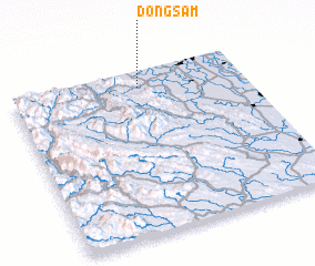 Places with similar names to Ðông Sầm, Vietnam ::
// Dangssama (TD)
// Tonkosom (NE)
// Tounga Samia (NE)
// Tongsŏm (KP)
// Dongoy Samou (ML)
// Tonkassimi (ML)
// Tongsam (MM)
// Ðâng Săm (VN)
// Dang Som (VN)
// Dằng Sùm (VN)
Disclaimer :: Information on this page comes without warranty of any kind |
||
|
Where is Ðông Sầm? Elevation and coordinates ::
Latitude (lat): 20°54'0"N Longitude (lon): 105°33'0"E
Elevation (approx.): 28m (map arrows pan, magnifying glasses zoom) |
||
|
Visiting Ðông Sầm? Hotel/Accommodation ::
Book a hotel in Ðông Sầm Travel Guide ::
Buy a travel guide for Vietnam rental cars ::
car rental offers GPS waypoint ::
download a GPX waypoint (PoI) of Ðông Sầm for your GPS receiver
|
||