|
search place name
|
||
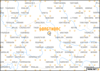
Ðông Thôn (2) (Hà Bắc, Vietnam)Ðông Thôn (2) is a town in the Hà Bắc region of Vietnam. An overview map of the region around Ðông Thôn (2) is displayed below.
regional and 3d topo map of Ðông Thôn (2), Vietnam ::
Ðông Thôn (2) airports ::
The nearest airport is HAN - Hanoi Noibai Intl, located 23.4 km west of Ðông Thôn (2).
Nearby towns ::
Hương Mai (1.7km east) //
Vân Câm (1.9km south) //
Làng Chàng (2.5km north east) //
Ðông Lỗ (2.5km south west) //
Lỗ Hạnh (2.5km south west) //
Xuân Lạn (3.9km south east) //
Thượng Thôn (3.9km north west) //
Phúc Thắng (3.9km north west) //
Chung Thôn (3.9km south west) //
Làng Chùa (5.1km north west) //
Danh Thắng (5.1km north west) //
Ngũ Phúc (5.1km south west) //
Dầu Thôn (5.2km east) //
Ngọc Sơn (5.6km north) //
Làng Gâm (5.6km south) //
Ðông Thôn (4) (5.8km south) //
Ðồng Tốt (5.5km west) //
Lạc Trung (5.8km south) //
Xóm Thượng (6.4km north east) //
Dĩnh Sơn (6.4km south east) //
Thôn Duc (6.5km south west) //
Ngọc Cụ (7.4km north) //
Ha Thôn (7.2km east) //
Sơn Quang (7.2km east) //
Ðâm Nội (7.2km east) //
Thọ Ðức (7.6km south) //
Hương Cáu (7.2km west) //
Trại Tụ (7.6km north) //
Ðức Thắng (7.6km north west) //
[all distances 'as the bird flies' and approximate] 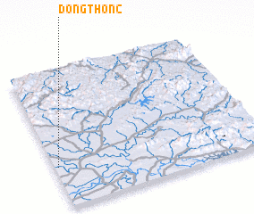 Places with similar names to Ðông Thôn (2), Vietnam ::
// Ðặng Thượng (VN)
// Ðông Thành (2) (VN)
// Ðông Thành (2) (VN)
// Ðông Thạnh (2) (VN)
// Ðồng Thung (VN)
// Ðông Thương (VN)
// Dường Thượng (VN)
// Duong Thuong (VN)
Disclaimer :: Information on this page comes without warranty of any kind |
||
|
Where is Ðông Thôn (2)? Elevation and coordinates ::
Latitude (lat): 21°18'0"N Longitude (lon): 106°1'0"E
Elevation (approx.): 8m (map arrows pan, magnifying glasses zoom) |
||
|
Visiting Ðông Thôn (2)? Hotel/Accommodation ::
Book a hotel in Ðông Thôn (2) Travel Guide ::
Buy a travel guide for Vietnam rental cars ::
car rental offers GPS waypoint ::
download a GPX waypoint (PoI) of Ðông Thôn (2) for your GPS receiver
|
||