|
search place name
|
||
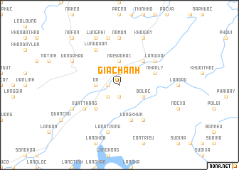
Gia Chanh (Lạng Sơn, Vietnam)Gia Chanh is a town in the Lạng Sơn region of Vietnam. An overview map of the region around Gia Chanh is displayed below.
regional and 3d topo map of Gia Chanh, Vietnam ::
Gia Chanh airports ::
The nearest airport is HAN - Hanoi Noibai Intl, located 97.3 km south west of Gia Chanh.
Other airports nearby include NNG - Nanning Wuxu (191.4 km north east), Nearby towns ::
Làng Nác (1.9km north) //
Lũng Tai (1.7km west) //
Lũng Tràu (1.9km south) //
Làng Ðàng (2.5km south west) //
Mai Sảo Hạ (2) (3.7km north) //
Ôn (3.4km west) //
Bô Lạc (3.9km south east) //
Khôn Khoan (5.1km north east) //
Ðồng Mỏ (5.1km south west) //
Nhân Lý (5.5km east) //
Làng Khùm (5.8km south) //
Làng Giai (6.4km north east) //
Hap Cay (6.5km south east) //
Lũng Quân (6.5km north west) //
Xuất Thang (6.4km south west) //
Nà Môm (7.4km north) //
Lũng Trừng (7.6km north) //
Làng Trang (7.6km south) //
Khối Ðầy (8.2km north east) //
Lũng Phi (8.2km north west) //
Ðong Phau (7.8km north west) //
Ðồng Lọt (7.8km north west) //
Thanh Moi (7.8km south west) //
Na Fan (10.1km north west) //
Cau Bon (10.1km north west) //
[all distances 'as the bird flies' and approximate] 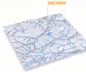 Places with similar names to Gia Chanh, Vietnam ::
Disclaimer :: Information on this page comes without warranty of any kind |
||
|
Where is Gia Chanh? Elevation and coordinates ::
Latitude (lat): 21°40'0"N Longitude (lon): 106°37'0"E
Elevation (approx.): 193m (map arrows pan, magnifying glasses zoom) |
||
|
Visiting Gia Chanh? Hotel/Accommodation ::
Book a hotel in Gia Chanh Travel Guide ::
Buy a travel guide for Vietnam rental cars ::
car rental offers GPS waypoint ::
download a GPX waypoint (PoI) of Gia Chanh for your GPS receiver
|
||