|
search place name
|
||
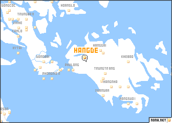
Háng Dê (Hải Phòng, Vietnam)Háng Dê is a town in the Hải Phòng region of Vietnam. An overview map of the region around Háng Dê is displayed below.
regional and 3d topo map of Háng Dê, Vietnam ::
Háng Dê airports ::
The nearest airport is HAN - Hanoi Noibai Intl, located 127.0 km west of Háng Dê.
Other airports nearby include NNG - Nanning Wuxu (235.3 km north east), Nearby towns ::
Phù Long (3.2km south west) //
Hang Gai (3.8km north east) //
Gia Luận (3.9km north east) //
Cát Hải (3.9km south west) //
Trung Trang (4.7km south east) //
Xóm Trong (5.1km south east) //
Hiến Hào (5.3km south east) //
Hòa Hy (5.5km west) //
Dồn Lưống (5.6km west) //
Chân Thôn (6.9km west) //
Hang Nha (7.6km south east) //
Xuân Ðàm (8.2km south east) //
Phong Niên (7.9km south west) //
Chân Châu (8.9km south east) //
[all distances 'as the bird flies' and approximate] 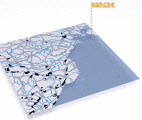 Places with similar names to Háng Dê, Vietnam ::
// Hanigad (PH)
// Honcut (US)
// Whangateau (NZ)
// Whenuakite (NZ)
// Honeycutt (US)
// Honeycutt (US)
// Huongodaa (ID)
// Hengoda (LK)
// Hunugoda (LK)
// Hunuketa (LK)
Disclaimer :: Information on this page comes without warranty of any kind |
||
|
Where is Háng Dê? Elevation and coordinates ::
Latitude (lat): 20°49'0"N Longitude (lon): 106°57'0"E
Elevation (approx.): 117m (map arrows pan, magnifying glasses zoom) |
||
|
Visiting Háng Dê? Hotel/Accommodation ::
Book a hotel in Háng Dê Travel Guide ::
Buy a travel guide for Vietnam rental cars ::
car rental offers GPS waypoint ::
download a GPX waypoint (PoI) of Háng Dê for your GPS receiver
|
||