|
search place name
|
||
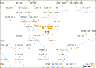
Han Xa (Vietnam)Han Xa is a town in Vietnam. An overview map of the region around Han Xa is displayed below.
regional and 3d topo map of Han Xa, Vietnam ::
Han Xa airports ::
The nearest airport is HAN - Hanoi Noibai Intl, located 203.5 km east of Han Xa.
Other airports nearby include LPQ - Luang Prabang Luang Phabang Intl (271.9 km south west), Nearby towns ::
Thuong Ho (0.0km north) //
Phay Cau (1.9km north) //
Khê Cây (1.7km east) //
Ba Bao (1.7km west) //
Nhu Nhiêu Phih (1.9km south) //
Po Chu Phin (1.9km south) //
Bo Chu (2.5km north west) //
Háng Tày (2.5km south east) //
Sóm Yên (2.5km south east) //
Hom Tày (2.5km south east) //
Bản Phây Ðiêng (3.7km north) //
Bản Vá (3.9km north east) //
Pú Vá (3.9km north east) //
Non Quan (3.9km north west) //
Bản Kiét (4.1km south east) //
Ouei Quang (3.9km south west) //
Hô Meu (5.1km north east) //
Bản Muoi (5.1km north west) //
Bản Chiu Ang (5.5km west) //
Ouei Lôc (5.5km west) //
Bản Nộm (5.5km west) //
Bản Phêu (6.4km north west) //
Na Ri (6.5km north west) //
Bản Ouei Hoa (6.4km south west) //
Bản Hoe Bã (6.4km south west) //
Chao Chai (7.4km north) //
Bản Sang (7.1km west) //
Bản Lêch (7.6km south) //
Tạng Khẻ (7.6km south) //
[all distances 'as the bird flies' and approximate] 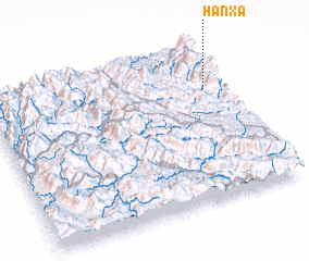 Places with similar names to Han Xa, Vietnam ::
Disclaimer :: Information on this page comes without warranty of any kind |
||
|
Where is Han Xa? Elevation and coordinates ::
Latitude (lat): 21°43'0"N Longitude (lon): 103°55'0"E
Elevation (approx.): 1576m (map arrows pan, magnifying glasses zoom) |
||
|
Visiting Han Xa? Hotel/Accommodation ::
Book a hotel in Han Xa Travel Guide ::
Buy a travel guide for Vietnam rental cars ::
car rental offers GPS waypoint ::
download a GPX waypoint (PoI) of Han Xa for your GPS receiver
|
||