|
search place name
|
||
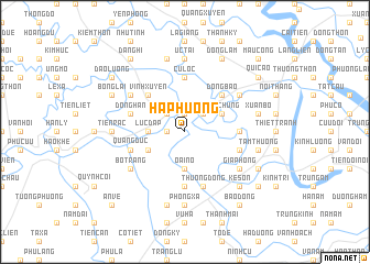
Ha Phương (Hải Phòng, Vietnam)Ha Phương is a town in the Hải Phòng region of Vietnam. An overview map of the region around Ha Phương is displayed below.
regional and 3d topo map of Ha Phương, Vietnam ::
Ha Phương airports ::
The nearest airport is HAN - Hanoi Noibai Intl, located 84.5 km north west of Ha Phương.
Other airports nearby include NNG - Nanning Wuxu (277.3 km north east), Nearby towns ::
Cưu Phu Phố (1.9km north) //
Lộng Khê (1.7km west) //
Hà Hải (2.5km north east) //
Ninh Giang (2.5km north west) //
Lực Ðáp (3.5km west) //
Oai Nỗ (3.7km south) //
Hữu Chung (3.9km north east) //
Hưng Nhượng (3.9km south west) //
Ðồng Bào (5.1km north east) //
Vĩnh Xuyên (5.1km north west) //
Cư Lộc (5.6km north) //
Ðưc Linh (5.6km south) //
Ang Dương (5.2km east) //
Cung Chúc (5.2km east) //
Ðồng Han (5.5km west) //
Thượng Ðồng (5.8km south) //
Quang Dưc (5.5km west) //
Ang Ngoại (5.5km east) //
La Khê (6.4km north west) //
An Thỗ (6.4km north east) //
Bồ Trang (6.4km south west) //
Gia Phong (6.4km south east) //
Ức Tai (7.4km north) //
Bồ Dương (6.9km west) //
Tiên Răc (6.9km west) //
Phong Xá (7.4km south) //
Xuân Bồ (7.2km east) //
Phúc Lâm (7.6km north) //
Tấm Thượng (7.2km east) //
[all distances 'as the bird flies' and approximate]  Places with similar names to Ha Phương, Vietnam ::
Disclaimer :: Information on this page comes without warranty of any kind |
||
|
Where is Ha Phương? Elevation and coordinates ::
Latitude (lat): 20°43'0"N Longitude (lon): 106°25'0"E
Elevation (approx.): 3m (map arrows pan, magnifying glasses zoom) |
||
|
Visiting Ha Phương? Hotel/Accommodation ::
Book a hotel in Ha Phương Travel Guide ::
Buy a travel guide for Vietnam rental cars ::
car rental offers GPS waypoint ::
download a GPX waypoint (PoI) of Ha Phương for your GPS receiver
|
||