|
search place name
|
||
Hớn Quản (Bình Phước, Vietnam)Hớn Quản is a town in the Bình Phước region of Vietnam. An overview map of the region around Hớn Quản is displayed below.
regional and 3d topo map of Hớn Quản, Vietnam ::

Hớn Quản airports ::
The nearest airport is SGN - Ho Chi Minh City Tansonnhat Intl, located 92.1 km south of Hớn Quản.
Other airports nearby include PNH - Phnom-penh Phnom Penh Intl (191.8 km west), Nearby towns ::
Thanh Bình (1.9km south) //
Ấp Bình Phú (3.6km west) //
Ấp An Phú (3.7km north) //
Ấp Ðông Long (3.7km north) //
Ấp Be Moi (4.1km north east) //
Ấp Ðông Phất (2) (4.1km south east) //
Xã Tân Lợi (4.1km north east) //
Ấp Kalali (5.2km north west) //
Làng Năm (5.2km south west) //
Ấp Phú Lô (5.8km west) //
Ấp Srok Rang (5.8km south) //
Ấp Phú Miêng (6.6km north east) //
Ấp Văn Hiến (6.6km south east) //
Srok Lich Lộc (6.6km south east) //
Ấp Canlê (7.4km north) //
Ấp Ðức Vinh (1) (7.4km south) //
Ấp Lộc Khê (7.6km south) //
Minh Ðức (7.6km south) //
Srok Ben Gaye (7.5km west) //
Ấp Lơi An (7.5km east) //
Ấp Ðức Vinh (2) (7.6km south) //
Ấp Xa Trạch (1) (8.3km south east) //
Ấp Phú Hưng (9.1km north east) //
Ấp Tân Lập Phú (9.1km north east) //
[all distances 'as the bird flies' and approximate] 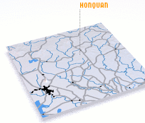 Places with similar names to Hớn Quản, Vietnam ::
Disclaimer :: Information on this page comes without warranty of any kind |
||
|
Where is Hớn Quản? Elevation and coordinates ::
Latitude (lat): 11°39'0"N Longitude (lon): 106°36'0"E
Elevation (approx.): 95m (map arrows pan, magnifying glasses zoom) |
||
|
Visiting Hớn Quản? Hotel/Accommodation ::
Book a hotel in Hớn Quản Travel Guide ::
Buy a travel guide for Vietnam rental cars ::
car rental offers GPS waypoint ::
download a GPX waypoint (PoI) of Hớn Quản for your GPS receiver
|
||