|
search place name
|
||
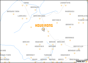
Houei Mong (Lai Châu, Vietnam)Houei Mong is a town in the Lai Châu region of Vietnam. An overview map of the region around Houei Mong is displayed below.
regional and 3d topo map of Houei Mong, Vietnam ::
Houei Mong airports ::
The nearest airport is LPQ - Luang Prabang Luang Phabang Intl, located 236.0 km south west of Houei Mong.
Nearby towns ::
Nong Cha (1.7km east) //
Cha Mong (1.7km east) //
Nong Bo (2.5km south east) //
Houei San (5.8km south) //
Bản Chong Ban (5.8km north) //
Bản Na Cho (5.5km west) //
Bản Kha (6.5km south east) //
Bản Ta Men (6.4km north east) //
Houei Chum (7.6km south) //
Bản Shan (8.2km south east) //
Bản Chan (8.9km south east) //
Bản Lom (8.9km north west) //
Bản Chin (8.9km south west) //
[all distances 'as the bird flies' and approximate] 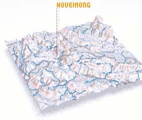 Places with similar names to Houei Mong, Vietnam ::
Disclaimer :: Information on this page comes without warranty of any kind |
||
|
Where is Houei Mong? Elevation and coordinates ::
Latitude (lat): 21°41'0"N Longitude (lon): 103°24'0"E
Elevation (approx.): 1004m (map arrows pan, magnifying glasses zoom) |
||
|
Visiting Houei Mong? Hotel/Accommodation ::
Book a hotel in Houei Mong Travel Guide ::
Buy a travel guide for Vietnam rental cars ::
car rental offers GPS waypoint ::
download a GPX waypoint (PoI) of Houei Mong for your GPS receiver
|
||