|
search place name
|
||
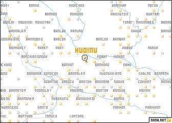
Huổi Nụ (Sơn La, Vietnam)Huổi Nụ is a town in the Sơn La region of Vietnam. An overview map of the region around Huổi Nụ is displayed below.
regional and 3d topo map of Huổi Nụ, Vietnam ::
Huổi Nụ airports ::
The nearest airport is HAN - Hanoi Noibai Intl, located 207.6 km east of Huổi Nụ.
Other airports nearby include LPQ - Luang Prabang Luang Phabang Intl (251.3 km south west), Nearby towns ::
Bản Lou (0.0km north) //
Bản Le (2) (1.7km east) //
Huổi Lẹ (1.7km east) //
Bản Huội Xất (2.5km south west) //
Bản Bắc (2.5km north west) //
Co Ðứa (2.5km north west) //
Pá Bát (3.4km east) //
Bản Kia (3.4km east) //
Bản Na Lân (4.1km south west) //
Bản Xắt (3.9km south west) //
Bản Na Xá (4.1km south east) //
Bản Na Hang (4.1km south east) //
Bản Lạng (3.9km north west) //
Bản Mang (3.9km south east) //
Bản Na Cáu (5.1km south west) //
Bản Le (1) (5.1km north east) //
Bản Nhốc (5.6km south) //
Bản Ðap Tong (5.6km south) //
Bản Tưm (5.6km south) //
Bản Na Ho (5.8km south) //
Bản Na Viêng (5.8km south) //
Pá Mùng (5.8km north) //
Pá Dôn (5.8km north) //
Bản Nuống (5.8km south) //
Bản Ở (5.8km south) //
Bản Khiêng (5.8km south) //
Bản Bóng (5.8km south) //
Pa Ét (5.5km west) //
Bản It Chiêng (5.5km west) //
[all distances 'as the bird flies' and approximate] 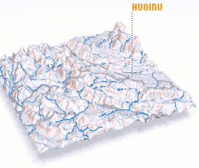 Places with similar names to Huổi Nụ, Vietnam ::
Disclaimer :: Information on this page comes without warranty of any kind |
||
|
Where is Huổi Nụ? Elevation and coordinates ::
Latitude (lat): 21°32'0"N Longitude (lon): 103°50'0"E
Elevation (approx.): 220m (map arrows pan, magnifying glasses zoom) |
||
|
Visiting Huổi Nụ? Hotel/Accommodation ::
Book a hotel in Huổi Nụ Travel Guide ::
Buy a travel guide for Vietnam rental cars ::
car rental offers GPS waypoint ::
download a GPX waypoint (PoI) of Huổi Nụ for your GPS receiver
|
||