|
search place name
|
||
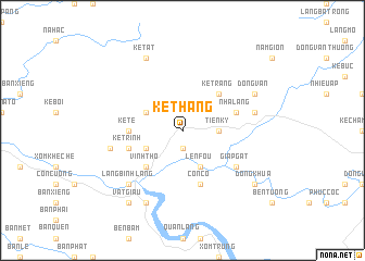
Ke Thang (Vietnam)Ke Thang is a town in Vietnam. An overview map of the region around Ke Thang is displayed below.
regional and 3d topo map of Ke Thang, Vietnam ::
Ke Thang airports ::
The nearest airport is SNO - Sakon Nakhon, located 229.6 km south west of Ke Thang.
Nearby towns ::
Làng Mới (1.9km south) //
Tiên Ky (3.5km east) //
Len Fou (4.1km south east) //
Ke Loa (4.1km south east) //
Cây Vải (4.0km south west) //
Kẻ Gia (4.0km north west) //
Kẻ Trang (5.1km north east) //
Vinh Thọ (5.1km south west) //
Kẻ Te (5.3km west) //
Kẻ Trai (5.6km west) //
Kẻ Trinh (5.6km west) //
Bến Cơi (5.8km south) //
Côn Có (5.8km south) //
Nhà Lang (5.6km east) //
Giap Gát (6.4km south east) //
Ke On (7.2km east) //
Kẻ Mẻ (7.2km west) //
Ðào Giang (7.7km south west) //
Làng Bình Lang (7.7km south west) //
Hội Lâm (8.2km south west) //
Dong Van (7.9km north east) //
Kẻ Tắt (8.2km north west) //
Vật Giâu (9.1km south west) //
Ðồng Khua (8.9km south east) //
[all distances 'as the bird flies' and approximate] 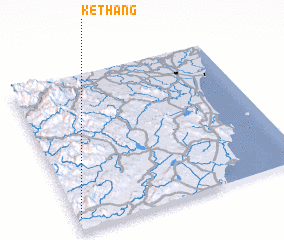 Places with similar names to Ke Thang, Vietnam ::
// Gouthang (IN)
// Gathanga (KE)
// Kathungu (KE)
// Kithungo (KE)
// Kothoniok (UG)
// Goth Neku (PK)
// Quthing (LS)
// Cao Thượng (VN)
// Cao Thượng (VN)
// Cầu Thượng (VN)
Disclaimer :: Information on this page comes without warranty of any kind |
||
|
Where is Ke Thang? Elevation and coordinates ::
Latitude (lat): 19°5'0"N Longitude (lon): 105°1'0"E
Elevation (approx.): 123m (map arrows pan, magnifying glasses zoom) |
||
|
Visiting Ke Thang? Hotel/Accommodation ::
Book a hotel in Ke Thang Travel Guide ::
Buy a travel guide for Vietnam rental cars ::
car rental offers GPS waypoint ::
download a GPX waypoint (PoI) of Ke Thang for your GPS receiver
|
||