|
search place name
|
||
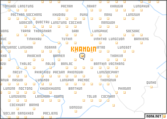
Khâm Ðin (Cao Bằng, Vietnam)Khâm Ðin is a town in the Cao Bằng region of Vietnam. An overview map of the region around Khâm Ðin is displayed below.
regional and 3d topo map of Khâm Ðin, Vietnam ::
Khâm Ðin airports ::
The nearest airport is NNG - Nanning Wuxu, located 156.6 km east of Khâm Ðin.
Other airports nearby include HAN - Hanoi Noibai Intl (182.2 km south west), Nearby towns ::
Lũng Mười (1.7km east) //
Lũng Nọt (1.7km east) //
Sộc Nhương (1.7km east) //
Ti Làn (1.9km south) //
Ðổng Sẳng (1.7km west) //
Nhi Liêu (1.7km west) //
Lênh Cầm (2.5km north east) //
Lũng Ðốn (2.5km north east) //
Hạ Lang (2.5km north east) //
Lũng Sung (2.5km north west) //
Tỉ Ðính (2.5km north west) //
Bản Quyên (2.5km south east) //
Khau Lưa (2.5km south west) //
Bản Sao (3.7km south) //
Lệnh Cấm (3.7km south) //
Bản Lạn (3.7km south) //
Nà Ðắng (3.9km north east) //
Sa Tao (3.9km north east) //
Bân Thìn (3.9km south east) //
Co Cam (2) (4.1km north west) //
Bản Lạc (3.9km south west) //
Phiêng Ðài (4.1km south west) //
Vĩnh Thọ (5.0km north east) //
Kéo Si (1) (5.0km north east) //
Bó Mực (5.0km north east) //
Tu Thin (5.0km north west) //
Bản Bủng (5.0km south east) //
Bản Nha (5.0km south west) //
Nà Kéo (5.1km east) //
[all distances 'as the bird flies' and approximate] 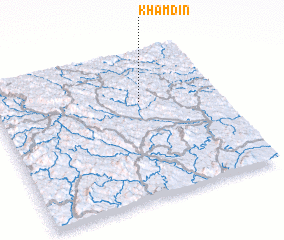 Places with similar names to Khâm Ðin, Vietnam ::
Disclaimer :: Information on this page comes without warranty of any kind |
||
|
Where is Khâm Ðin? Elevation and coordinates ::
Latitude (lat): 22°40'0"N Longitude (lon): 106°39'0"E
Elevation (approx.): 434m (map arrows pan, magnifying glasses zoom) |
||
|
Visiting Khâm Ðin? Hotel/Accommodation ::
Book a hotel in Khâm Ðin Travel Guide ::
Buy a travel guide for Vietnam rental cars ::
car rental offers GPS waypoint ::
download a GPX waypoint (PoI) of Khâm Ðin for your GPS receiver
|
||