|
search place name
|
||
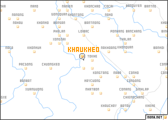
Khâu Kheo (Lạng Sơn, Vietnam)Khâu Kheo is a town in the Lạng Sơn region of Vietnam. An overview map of the region around Khâu Kheo is displayed below.
regional and 3d topo map of Khâu Kheo, Vietnam ::
Khâu Kheo airports ::
The nearest airport is HAN - Hanoi Noibai Intl, located 129.6 km west of Khâu Kheo.
Other airports nearby include NNG - Nanning Wuxu (164.6 km north east), Nearby towns ::
Còn Liên (1.9km south) //
Tô Khê (1.7km east) //
Keo Phai (2.5km south east) //
Cung Khoái (5.1km north west) //
Kổng Tang (5.1km south east) //
Lợi Bác (5.6km north) //
Na Khoang (5.5km east) //
May Cướng (5.8km south) //
Xong Sai (6.4km north west) //
Bản Chênh (6.5km north west) //
Bản Trong (7.6km north) //
Chương Kêo (7.1km west) //
Nhạt Bon (7.6km south) //
Phá Lan (7.6km north west) //
Khuổi Chai (7.8km north west) //
Na Ba (7.8km south east) //
Ðồng Mô (8.2km south east) //
Bản San (9.0km north west) //
Pò Nhang (8.9km north east) //
[all distances 'as the bird flies' and approximate] 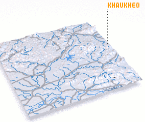 Places with similar names to Khâu Kheo, Vietnam ::
Disclaimer :: Information on this page comes without warranty of any kind |
||
|
Where is Khâu Kheo? Elevation and coordinates ::
Latitude (lat): 21°37'0"N Longitude (lon): 106°59'0"E
Elevation (approx.): 388m (map arrows pan, magnifying glasses zoom) |
||
|
Visiting Khâu Kheo? Hotel/Accommodation ::
Book a hotel in Khâu Kheo Travel Guide ::
Buy a travel guide for Vietnam rental cars ::
car rental offers GPS waypoint ::
download a GPX waypoint (PoI) of Khâu Kheo for your GPS receiver
|
||