|
search place name
|
||
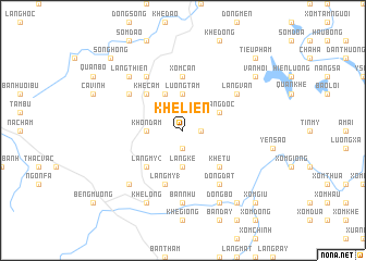
Khê Liên (Vietnam)Khê Liên is a town in Vietnam. An overview map of the region around Khê Liên is displayed below.
regional and 3d topo map of Khê Liên, Vietnam ::
Khê Liên airports ::
The nearest airport is HAN - Hanoi Noibai Intl, located 110.6 km east of Khê Liên.
Nearby towns ::
Làng Lương (1.9km south) //
Thanh Bồng (1.7km east) //
Khon Dam (3.4km west) //
Lương Tàm (3.7km north) //
Làng Kè (3.7km south) //
Càn Lộc (4.1km north west) //
Làng Dọc (3.9km north east) //
Khề Cam (5.1km north west) //
Làng Mỹ (2) (5.1km south west) //
Khê Tú (5.1km south east) //
Xóm Cận (5.6km north) //
Khê Xung (5.8km south) //
Làng Mỹ (1) (5.8km south) //
Làng Vân (6.4km north east) //
Cốn Bổ (6.4km north west) //
Khê Nghên (6.5km north west) //
Ðồng Ðát (6.5km south east) //
Bản Nhù (7.4km south) //
Làng Khê Ðịa (7.6km south west) //
Làng Thiên (7.6km north west) //
Khé Long (8.2km south west) //
Bản Chùa (8.2km south east) //
Dồng Bồ (8.2km south east) //
Làng Cam (9.0km south east) //
Vân Hội (8.9km north east) //
Song Hồng (10.1km north west) //
Tiểu Phạm (10.1km north east) //
Xóm Giu (10.1km south east) //
[all distances 'as the bird flies' and approximate] 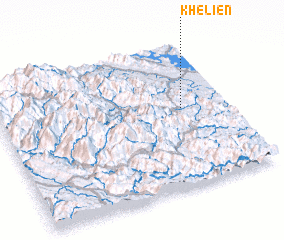 Places with similar names to Khê Liên, Vietnam ::
Disclaimer :: Information on this page comes without warranty of any kind |
||
|
Where is Khê Liên? Elevation and coordinates ::
Latitude (lat): 21°33'0"N Longitude (lon): 104°48'0"E
Elevation (approx.): 294m (map arrows pan, magnifying glasses zoom) |
||
|
Visiting Khê Liên? Hotel/Accommodation ::
Book a hotel in Khê Liên Travel Guide ::
Buy a travel guide for Vietnam rental cars ::
car rental offers GPS waypoint ::
download a GPX waypoint (PoI) of Khê Liên for your GPS receiver
|
||