|
search place name
|
||
Khon Lung Om (Lạng Sơn, Vietnam)Khon Lung Om is a town in the Lạng Sơn region of Vietnam. An overview map of the region around Khon Lung Om is displayed below.
regional and 3d topo map of Khon Lung Om, Vietnam ::

Khon Lung Om airports ::
The nearest airport is HAN - Hanoi Noibai Intl, located 86.8 km south west of Khon Lung Om.
Other airports nearby include NNG - Nanning Wuxu (202.1 km north east), Nearby towns ::
Vạn Linh (1.9km south) //
Khon Lung Na (2.5km south west) //
Khon Lung Khut (2.5km north east) //
Làng Kouan (2.5km north east) //
Khun Dut (3.4km west) //
Khon Day Lua (3.7km north) //
Mo Cây (3.9km south west) //
Làng Gia (4.1km south west) //
Na Tinh (3.9km north east) //
Khon Ba Thao (5.6km north) //
Keo Phay (5.8km north) //
Len Cham (6.9km west) //
Keo Thi (7.4km north) //
Leo Loung (7.4km north) //
Na Coc (7.1km west) //
Ðồng Lọt (7.1km east) //
Ðong Phau (7.1km east) //
Bản So (7.6km north west) //
Len Ruong (8.2km south west) //
Quan Câu (9.0km south east) //
Na Fan (8.9km north east) //
Cau Bon (8.9km north east) //
Thanh Moi (8.9km south east) //
Bản Dioi (10.1km north west) //
[all distances 'as the bird flies' and approximate] 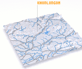 Places with similar names to Khon Lung Om, Vietnam :: Disclaimer :: Information on this page comes without warranty of any kind |
||
|
Where is Khon Lung Om? Elevation and coordinates ::
Latitude (lat): 21°41'0"N Longitude (lon): 106°29'0"E
Elevation (approx.): 358m (map arrows pan, magnifying glasses zoom) |
||
|
Visiting Khon Lung Om? Hotel/Accommodation ::
Book a hotel in Khon Lung Om Travel Guide ::
Buy a travel guide for Vietnam rental cars ::
car rental offers GPS waypoint ::
download a GPX waypoint (PoI) of Khon Lung Om for your GPS receiver
|
||