|
search place name
|
||
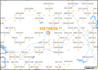
Kim Thành (Vietnam)Kim Thành is a town in Vietnam. An overview map of the region around Kim Thành is displayed below.
regional and 3d topo map of Kim Thành, Vietnam ::
Kim Thành airports ::
The nearest airport is SNO - Sakon Nakhon, located 241.5 km south west of Kim Thành.
Nearby towns ::
Tien Xa (0.0km north) //
Vặn Thành (0.0km north) //
Xuan Nguyên (1.9km north) //
Vĩnh Ðòng (1.9km south) //
Tam Ðông (1.9km south) //
Quan Hóa (2.6km north east) //
Chụ Thạch (2.6km south west) //
Vân Nam (2.6km south east) //
Phúc Thành (2.6km south west) //
Lâm Xuyên (1) (3.5km east) //
Phú Thọ (3.5km east) //
Ðồng Văn (3.5km west) //
Liên Trì (3.7km south) //
Phúc Duệ (3.7km south) //
Tú Phúc (4.0km north east) //
Doai Moi (4.0km north east) //
Van Trai (4.0km south east) //
Văn Sơn (4.0km south east) //
Yên Thành (4.1km north east) //
Phúc Tang (4.1km north east) //
Nôi Trung (4.1km south west) //
Viên Sơn (4.1km south east) //
Yên Xá (5.1km south east) //
Danh Nham (5.1km south east) //
Ngọc Long Ha (5.6km south) //
Nam Thôn (5.6km south) //
Thọ Vính (5.6km east) //
Xuân Tiêu (5.6km east) //
Vinh Tuy (5.6km east) //
[all distances 'as the bird flies' and approximate] 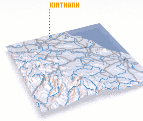 Places with similar names to Kim Thành, Vietnam ::
Disclaimer :: Information on this page comes without warranty of any kind |
||
|
Where is Kim Thành? Elevation and coordinates ::
Latitude (lat): 18°58'0"N Longitude (lon): 105°27'0"E
Elevation (approx.): 5m (map arrows pan, magnifying glasses zoom) |
||
|
Visiting Kim Thành? Hotel/Accommodation ::
Book a hotel in Kim Thành Travel Guide ::
Buy a travel guide for Vietnam rental cars ::
car rental offers GPS waypoint ::
download a GPX waypoint (PoI) of Kim Thành for your GPS receiver
|
||