|
search place name
|
||
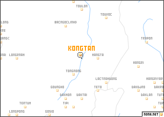
Kong Tan (Vietnam)Kong Tan is a town in Vietnam. An overview map of the region around Kong Tan is displayed below.
regional and 3d topo map of Kong Tan, Vietnam ::
Kong Tan airports ::
The nearest airport is DAD - Danang Intl, located 106.8 km north of Kong Tan.
Nearby towns ::
Sion (2.6km north east) //
Mang Ta (3.6km east) //
Tong Nong (4.1km south west) //
Lac Trom Dong (7.7km south east) //
Teto (8.2km south east) //
Bắc Ngọc Linh (3) (8.2km north west) //
Goung Ho (9.2km south west) //
[all distances 'as the bird flies' and approximate]  Places with similar names to Kong Tan, Vietnam ::
// Canagatan (PH)
// Canoctan (PH)
// Guinacutan (PH)
// Kangtunao (PH)
// Kinagatan (PH)
// Kinagatan (PH)
// Kinoguitan (PH)
// Kingtown (US)
// Kingtown (US)
// Kingtown (US)
Disclaimer :: Information on this page comes without warranty of any kind |
||
|
Where is Kong Tan? Elevation and coordinates ::
Latitude (lat): 15°5'0"N Longitude (lon): 108°6'0"E
Elevation (approx.): 404m (map arrows pan, magnifying glasses zoom) |
||
|
Visiting Kong Tan? Hotel/Accommodation ::
Book a hotel in Kong Tan Travel Guide ::
Buy a travel guide for Vietnam rental cars ::
car rental offers GPS waypoint ::
download a GPX waypoint (PoI) of Kong Tan for your GPS receiver
|
||