|
search place name
|
||
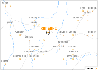
Kon Sok (2) (Vietnam)Kon Sok (2) is a town in Vietnam. An overview map of the region around Kon Sok (2) is displayed below.
regional and 3d topo map of Kon Sok (2), Vietnam ::
Kon Sok (2) airports ::
The nearest airport is DAD - Danang Intl, located 153.5 km north of Kon Sok (2).
Nearby towns ::
Plei Loe (1.9km north) //
Kon Braih Monome (2) (2.6km south west) //
Kon Sling (5.2km north west) //
Công Plông (5.2km south east) //
Dak Jeroi (5.4km east) //
Dak Boum (5.4km east) //
Mak Pan (6.5km north west) //
Kon Plong (3) (6.6km south east) //
Kon Koliak (1) (6.6km south west) //
Kon Plong (5) (6.5km south east) //
Dak Nghe (7.4km west) //
Kon Rolang (1) (7.6km south) //
Mang Canh (7.7km north west) //
Kon Kopek (2) (7.7km south west) //
Kon Konang (9.1km south west) //
Kon Von Kla (10.3km south west) //
[all distances 'as the bird flies' and approximate] 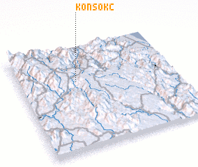 Places with similar names to Kon Sok (2), Vietnam ::
// Guanzigoukou (CN)
Disclaimer :: Information on this page comes without warranty of any kind |
||
|
Where is Kon Sok (2)? Elevation and coordinates ::
Latitude (lat): 14°40'0"N Longitude (lon): 108°22'0"E
Elevation (approx.): 1221m (map arrows pan, magnifying glasses zoom) |
||
|
Visiting Kon Sok (2)? Hotel/Accommodation ::
Book a hotel in Kon Sok (2) Travel Guide ::
Buy a travel guide for Vietnam rental cars ::
car rental offers GPS waypoint ::
download a GPX waypoint (PoI) of Kon Sok (2) for your GPS receiver
|
||