|
search place name
|
||
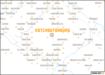
Ko Tchou Tohoung (Vietnam)Ko Tchou Tohoung is a town in Vietnam. An overview map of the region around Ko Tchou Tohoung is displayed below.
regional and 3d topo map of Ko Tchou Tohoung, Vietnam ::
Ko Tchou Tohoung airports ::
The nearest airport is HAN - Hanoi Noibai Intl, located 229.1 km south east of Ko Tchou Tohoung.
Nearby towns ::
Ping Ho (2) (0.0km north) //
Li Kouei Tsing (1.7km west) //
Thôn Pèng (3.9km north east) //
Bản Phung (3.9km south east) //
Làng Cốc (4.1km north east) //
Nậm Hang Xa (4.1km north east) //
Bac Cai (4.1km north east) //
Phùng Mèo (4.1km south east) //
Phùng Mán (4.1km south east) //
Bò Lây (5.0km north east) //
Hường Vinh (5.0km south east) //
Tả Phời (5.6km north) //
Lừu Sang Hồ (5.6km north) //
Bản Kim (5.6km south) //
Bắc Cong (5.5km east) //
Làng Phuoi (5.8km north) //
Bản Sái (5.8km south) //
Ban Phùng (5.8km south) //
Lếch Mèo (5.8km south) //
Bản Chin (5.8km south) //
Bản Sai (6.5km south east) //
Hao Su Ngai (6.3km south west) //
Hoa Si Pan (6.5km south west) //
Chan Tchan (6.9km west) //
Làng Ðá Ðinh (7.4km north) //
Vang Neu Sou (7.4km south) //
Chu Lìn (7.1km west) //
Bản Thượng (7.1km east) //
Hầu Trư Ngài (7.1km west) //
[all distances 'as the bird flies' and approximate] 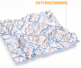 Places with similar names to Ko Tchou Tohoung, Vietnam :: Disclaimer :: Information on this page comes without warranty of any kind |
||
|
Where is Ko Tchou Tohoung? Elevation and coordinates ::
Latitude (lat): 22°21'0"N Longitude (lon): 103°57'0"E
Elevation (approx.): 803m (map arrows pan, magnifying glasses zoom) |
||
|
Visiting Ko Tchou Tohoung? Hotel/Accommodation ::
Book a hotel in Ko Tchou Tohoung Travel Guide ::
Buy a travel guide for Vietnam rental cars ::
car rental offers GPS waypoint ::
download a GPX waypoint (PoI) of Ko Tchou Tohoung for your GPS receiver
|
||