|
search place name
|
||
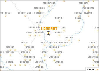
Làng Bát (Vietnam)Làng Bát is a town in Vietnam. An overview map of the region around Làng Bát is displayed below.
regional and 3d topo map of Làng Bát, Vietnam ::
Làng Bát airports ::
The nearest airport is HAN - Hanoi Noibai Intl, located 165.8 km south east of Làng Bát.
Nearby towns ::
Làng Tốc (1.9km north) //
Làng Tioum (2.5km north east) //
Nậm Bút (3.4km east) //
Làng Pin (3.4km west) //
Bắc Xảo (4.1km south east) //
Làng Còu (4.1km south west) //
Nam Ngàc (5.0km north west) //
Làng My (5.1km west) //
Bắc Quang (5.5km west) //
Làng Quang (5.5km west) //
Làng Khâu (5.8km south) //
Cô Lai (5.5km east) //
Nam Pha (6.5km north east) //
Bằng Hành (6.3km south east) //
Năm Ky (6.9km west) //
Làng Thac (7.1km east) //
Làng Mé (7.6km south) //
Bản Tchan (8.2km north west) //
Làng Ca (8.2km south east) //
Làng Xâng (8.8km south west) //
[all distances 'as the bird flies' and approximate]  Places with similar names to Làng Bát, Vietnam ::
// Luengbata (ID)
// Langābād (IR)
// Langābād (IR)
// Langbata (NG)
// Lengbati (PG)
// Làng Baout (VN)
// Làng Bat (VN)
// Làng Bệt (VN)
// Loung Bout (VN)
Disclaimer :: Information on this page comes without warranty of any kind |
||
|
Where is Làng Bát? Elevation and coordinates ::
Latitude (lat): 22°28'0"N Longitude (lon): 104°55'0"E
Elevation (approx.): 110m (map arrows pan, magnifying glasses zoom) |
||
|
Visiting Làng Bát? Hotel/Accommodation ::
Book a hotel in Làng Bát Travel Guide ::
Buy a travel guide for Vietnam rental cars ::
car rental offers GPS waypoint ::
download a GPX waypoint (PoI) of Làng Bát for your GPS receiver
|
||