|
search place name
|
||
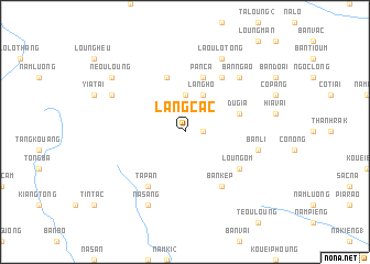
Làng Cac (Vietnam)Làng Cac is a town in Vietnam. An overview map of the region around Làng Cac is displayed below.
regional and 3d topo map of Làng Cac, Vietnam ::
Làng Cac airports ::
The nearest airport is HAN - Hanoi Noibai Intl, located 199.1 km south of Làng Cac.
Nearby towns ::
Muong Cha (1.7km east) //
Bản Lo (3.7km north) //
Làng Ho (4.1km north east) //
Pan Ca (5.8km north) //
Du Gia (5.4km east) //
Dường Thượng (5.8km north) //
Lao Lang Sa (6.5km north east) //
Bản Kep (6.5km south east) //
Loung Om (6.3km south east) //
Ta Pan (6.5km south west) //
Bản Li (7.1km east) //
Bản Ngao (7.6km north east) //
Na Sang (8.2km south west) //
Laou Lo Tong (8.2km north east) //
Pia Han (7.8km north west) //
Ta La (7.8km north west) //
Neou Loung (8.8km north west) //
[all distances 'as the bird flies' and approximate] 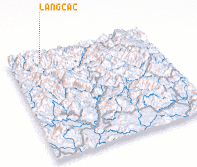 Places with similar names to Làng Cac, Vietnam ::
Disclaimer :: Information on this page comes without warranty of any kind |
||
|
Where is Làng Cac? Elevation and coordinates ::
Latitude (lat): 22°56'0"N Longitude (lon): 105°13'0"E
Elevation (approx.): 413m (map arrows pan, magnifying glasses zoom) |
||
|
Visiting Làng Cac? Hotel/Accommodation ::
Book a hotel in Làng Cac Travel Guide ::
Buy a travel guide for Vietnam rental cars ::
car rental offers GPS waypoint ::
download a GPX waypoint (PoI) of Làng Cac for your GPS receiver
|
||