|
search place name
|
||
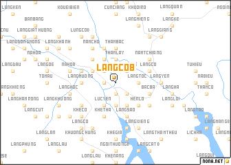
Làng Côb (Vietnam)Làng Côb is a town in Vietnam. An overview map of the region around Làng Côb is displayed below.
regional and 3d topo map of Làng Côb, Vietnam ::
Làng Côb airports ::
The nearest airport is HAN - Hanoi Noibai Intl, located 151.5 km south east of Làng Côb.
Nearby towns ::
Làng Súng (1.9km south) //
Làng Thấm (1.7km west) //
Làng Chuong (2.5km south east) //
Làng Nghe (2.5km north east) //
Làng Meo (2.5km north west) //
Làng Toc (3.4km east) //
Bản Nghè (3.4km east) //
Luc An Châu (3.7km south) //
Thâm Lay (3.7km north) //
Ðào Lâm (4.1km south east) //
Lục Yên (4.1km south west) //
Làng Muôi (4.1km north west) //
Làng Bươm (3.9km north west) //
Hen Lò (5.1km south east) //
Làng Chap (5.1km north west) //
Thẩm Bấc (5.6km north) //
Làng Mường (5.2km west) //
Bac Ba (5.5km east) //
Làng São (5.8km south) //
Làng Cố (5.5km east) //
Khe Tha (5.8km south) //
Lâm Trường Thượng (5.8km north) //
Làng Trăng (5.8km north) //
Làng Nọc (5.5km west) //
Dồng Banh (6.3km south east) //
Khôn Chung (6.3km south west) //
Làng Na Tương (6.3km north east) //
Nam Tchiang (6.3km north east) //
Nam Cho (6.5km north west) //
[all distances 'as the bird flies' and approximate] 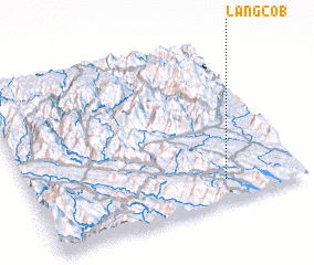 Places with similar names to Làng Côb, Vietnam ::
// Langkuba (ID)
// Lingkobu (ID)
// Làng Ca (1) (VN)
// Làng Cao (1) (VN)
// Làng Qua (1) (VN)
// Lung Co (1) (VN)
Disclaimer :: Information on this page comes without warranty of any kind |
||
|
Where is Làng Côb? Elevation and coordinates ::
Latitude (lat): 22°8'0"N Longitude (lon): 104°43'0"E
Elevation (approx.): 131m (map arrows pan, magnifying glasses zoom) |
||
|
Visiting Làng Côb? Hotel/Accommodation ::
Book a hotel in Làng Côb Travel Guide ::
Buy a travel guide for Vietnam rental cars ::
car rental offers GPS waypoint ::
download a GPX waypoint (PoI) of Làng Côb for your GPS receiver
|
||