|
search place name
|
||
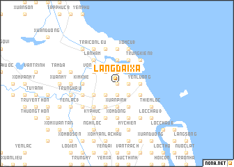
Làng Dại Xá (Vietnam)Làng Dại Xá is a town in Vietnam. An overview map of the region around Làng Dại Xá is displayed below.
regional and 3d topo map of Làng Dại Xá, Vietnam ::
Làng Dại Xá airports ::
The nearest airport is SNO - Sakon Nakhon, located 244.3 km south west of Làng Dại Xá.
Nearby towns ::
Long Trảo (0.0km north) //
Văn Xâ (1) (0.0km north) //
Ðưc Võng (0.0km north) //
Làng Trung (0.0km north) //
Xuân Âng (1.9km north) //
Xuân Hoa (1.9km south) //
Yên Trạch (1.8km east) //
Mai Lĩnh (1.8km east) //
Mỹ Xa (2.6km north west) //
Tân Lộc (2.6km north east) //
Kim Khê (2.6km south west) //
Ðông Thôn (2.6km south east) //
Thu Lũng (2.6km south east) //
Trị Thủy (3.7km north) //
Dông Ngàn (3.7km north) //
Xóm Xuân Huy (3.7km south) //
Xuân Pinh (3.7km south) //
Yên Lương (3.5km east) //
Cửa Lô (3.5km east) //
Thương Xà (2) (3.5km east) //
Vong Nhi (4.0km north west) //
Làng Nam Doai (4.0km south west) //
Làng Ðiên Cat (4.0km south west) //
Làng Co (4.1km north east) //
Kỳ Trân (4.1km south west) //
Xóm Kin Doi (4.1km south west) //
Văn Trung (4.1km south east) //
Dông Quan (4.0km south east) //
La Nham (5.1km north west) //
[all distances 'as the bird flies' and approximate] 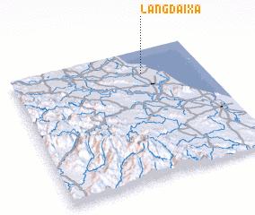
Disclaimer :: Information on this page comes without warranty of any kind |
||
|
Where is Làng Dại Xá? Elevation and coordinates ::
Latitude (lat): 18°49'0"N Longitude (lon): 105°41'0"E
Elevation (approx.): 2m (map arrows pan, magnifying glasses zoom) |
||
|
Visiting Làng Dại Xá? Hotel/Accommodation ::
Book a hotel in Làng Dại Xá Travel Guide ::
Buy a travel guide for Vietnam rental cars ::
car rental offers GPS waypoint ::
download a GPX waypoint (PoI) of Làng Dại Xá for your GPS receiver
|
||