|
search place name
|
||
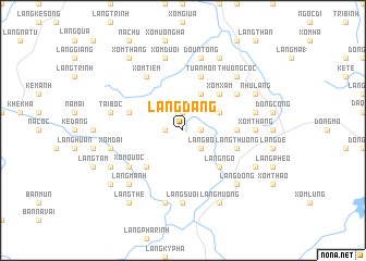
Làng Ðang (Thanh Hóa, Vietnam)Làng Ðang is a town in the Thanh Hóa region of Vietnam. An overview map of the region around Làng Ðang is displayed below.
regional and 3d topo map of Làng Ðang, Vietnam ::
Làng Ðang airports ::
The nearest airport is HAN - Hanoi Noibai Intl, located 176.4 km north of Làng Ðang.
Nearby towns ::
Xóm Cốc (1.7km east) //
Tại Bon (1.9km north) //
Hon Dương (1.9km north) //
Ðồng Phụng (1.7km west) //
Làng Bỏ (2.5km south east) //
Cát Dân (4.0km north east) //
Xóm Quần (4.1km north east) //
Làng Ngo (5.1km south east) //
Làng Hô (5.1km south east) //
Làng Ðôn (5.1km south east) //
Xóm Ca (5.1km south west) //
Xóm Xâm (5.1km north east) //
Làng Pheo (5.2km east) //
Làng Thượng (5.6km east) //
Tuân Môn (5.8km north) //
Lâm Lư (5.6km west) //
Xóm Quốc (6.4km south west) //
Xóm Tiêm (6.6km north west) //
Làng Sung (6.4km north east) //
Binh Van (6.4km north east) //
Làng Suối (7.4km south) //
Xóm Tháng (7.0km east) //
Làng Cò Hat (7.6km south) //
Cư Ðưc (7.2km east) //
Xóm Ðai (7.2km west) //
Doun Tong (7.6km north) //
Ðồng Nàng (2) (7.6km north) //
Tai Bôc (7.2km west) //
Xóm Dươi (7.6km north) //
[all distances 'as the bird flies' and approximate] 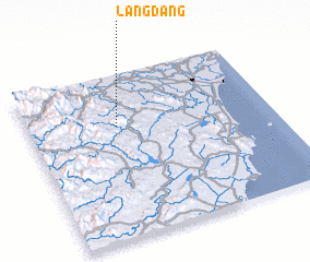 Places with similar names to Làng Ðang, Vietnam ::
// Lingatong (PH)
// Liung Tangah (PH)
// Long Tengoa (MY)
// Langting (IN)
// Lengteng (IN)
// Lungding (IN)
// Lingadang (ID)
// Langtang (NG)
// Long Tong (LA)
// Longtawng (MM)
Disclaimer :: Information on this page comes without warranty of any kind |
||
|
Where is Làng Ðang? Elevation and coordinates ::
Latitude (lat): 19°41'0"N Longitude (lon): 105°22'0"E
Elevation (approx.): 156m (map arrows pan, magnifying glasses zoom) |
||
|
Visiting Làng Ðang? Hotel/Accommodation ::
Book a hotel in Làng Ðang Travel Guide ::
Buy a travel guide for Vietnam rental cars ::
car rental offers GPS waypoint ::
download a GPX waypoint (PoI) of Làng Ðang for your GPS receiver
|
||