|
search place name
|
||
Làng Ðôn (Vietnam)Làng Ðôn is a town in Vietnam. An overview map of the region around Làng Ðôn is displayed below.
regional and 3d topo map of Làng Ðôn, Vietnam ::

Làng Ðôn airports ::
The nearest airport is HAN - Hanoi Noibai Intl, located 190.4 km south east of Làng Ðôn.
Nearby towns ::
Nghĩa Ðô (1.9km north) //
Nghĩa Ðô Tong (1.7km east) //
Nậm So (1.7km west) //
Nậm Nhàm (3.9km south east) //
Làng Nguyon (5.1km east) //
Bản Gay (5.1km west) //
Làng Xât Xá (5.8km north) //
Làng Kouei (5.8km south) //
Nâm Hanh (6.3km south west) //
Làng Măc (6.3km south east) //
Cốc Ðiệp (6.5km south east) //
Làng Bat (6.5km south west) //
Nàm Louc (6.3km north west) //
Bản La (6.3km north west) //
Làng Sinh (7.6km north east) //
Nậm Hoắc (7.6km south east) //
Làng Mang (8.2km north east) //
Ná Nồm (8.2km north east) //
Làng Khao (7.8km south east) //
Làng Luan (9.0km south west) //
Làng Hou (9.0km north west) //
Nam Dậm Dảm (9.0km north west) //
Làng Băng (9.0km north east) //
Nà Môi (8.8km north east) //
Nậm Ja (8.8km north west) //
Gôc Diệp (10.1km south east) //
[all distances 'as the bird flies' and approximate] 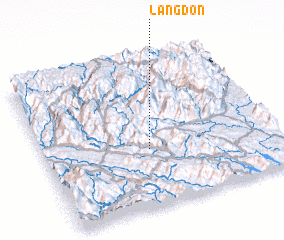 Places with similar names to Làng Ðôn, Vietnam ::
Disclaimer :: Information on this page comes without warranty of any kind |
||
|
Where is Làng Ðôn? Elevation and coordinates ::
Latitude (lat): 22°23'0"N Longitude (lon): 104°27'0"E
Elevation (approx.): 164m (map arrows pan, magnifying glasses zoom) |
||
|
Visiting Làng Ðôn? Hotel/Accommodation ::
Book a hotel in Làng Ðôn Travel Guide ::
Buy a travel guide for Vietnam rental cars ::
car rental offers GPS waypoint ::
download a GPX waypoint (PoI) of Làng Ðôn for your GPS receiver
|
||